Geoscience Reference
In-Depth Information
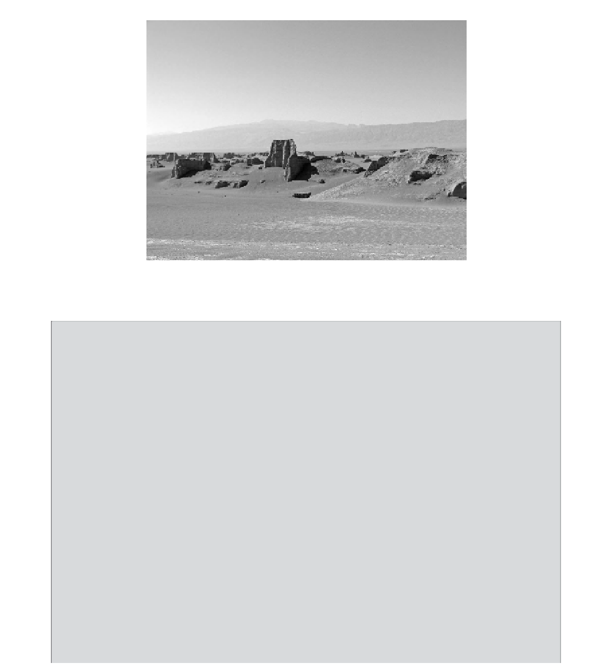
Figure 21.8
Yardang in the Lut Desert, Iran. Yardangs in the northern part of the Lut Desert are modified by solution, solifluction,
gullying and wind erosion and lack the streamlined form of the 'classic' yardang. The surfaces of many yardangs are extensively
modified by water and may be cut into buttes with vertical cliffs (photo courtesy of Majid Karimpour Reihan).
Box 21.1
The mega yardangs of the Lut (Loot) Desert
The lowest elevation in Iran, and the most arid region of the central plateau, is the Lut Desert (Farpoor and Krouse,
2008), an area of about 80 000 km
2
, which is home to yardangs, sand dunes, regs and playas. The Lut Desert is
extremely dry, with an average annual rainfall of less than 10 mm, and many years may pass without precipitation.
In 2004, the Lut Desert was described as the 'thermal pole of the Earth', with the hottest land surface temperature
(LST) recorded (68
◦
C) (Mildrexler, Zhao and Running, 2006).
Yardangs occupy much of the west-central Lut in a 150 km long by 50 km wide field. The north-northwest
trending yardangs cut across late Pleistocene lakebeds at altitudes that range from 100 m in the north and east to
404 m above sea level in the central and southeastern region (Ehsani and Quiel, 2008). The yardang field is bounded
to the north and south by transverse faults, which, together with longitudinal bounding faults, enclose a depression
in the shape of a parallelogram (Neev and Hall, 1992). The surrounding mountain ranges rise to heights of more
than 3000 m. The wind is channelled into the graben, flowing northward in winter and southward in summer. At
the southern end of the field, the north-northwest trending yardangs diverge to extend parallel to the east-southeast
trending transverse fault, eventually merging with it. Neev and Hall (1992) suggest a genetic relationship between
active tectonic processes and the yardang field. Longitudinal joints, fractures and faults offer less resistance to wind
erosion owing to soil crushing processes. The wind is channelled along them, thereby reinforcing wind erosion.
The yardangs are yellowish-red in colour and sculptured into strange shapes that are sometimes referred to as
Kalut
or desert cities (Gabriel, 1938) (Figure 21.8). The ridges are up to 80 m high and are separated by troughs
more than 100 m in width (McCauley, Breed and Grolier, 1977). The corridors are eroded by sand and dunes
(Gabriel, 1938; Krinsley, 1970; Alavi Panah
et al.
, 2007), moving from the north to the south through the field
(Krinsley, 1970).
The extensive yardang field is clearly visible on satellite imagery and represents erosional remnants of the
original valley surface. The yardangs are orientated at 330
◦
(northwest to southeast), parallel to the prevailing
winds, which reach their greatest intensity in April, with an average speed of 9.35 m/s (Ehsani and Quiel, 2008).
The yardangs are formed from Pleistocene lake deposits (Bobek, 1969), formed from easily erodible clays, which
include illite, kaolinite, montmorillonite and chlorite (Farpoor and Krouse, 2008). The presence of palygorskite in