Geoscience Reference
In-Depth Information
+
+
+
+
+
+
+
105°
110°E
+
+
+
+
+
+
+
+
+
+
+
+
+
+
+
+
+
+
+
+
+
(
el
V
+
+
+
V
+
HOHHOT
+
+
V
V
V
V
V
V
+
+
+
V
V
V
V
V
V
V
V
+
+
+
V
V
V
V
V
V
V
V
V
V
+
+
+
+
V
V
V
+
V
40°N
V
+
V
V
+
+
+
+
+
+
V
V
V
+
+
+
+
V
+
+
+
+
+
+
+
+
+
V
V
V
V
+
+
+
+
+
+
+
+
V
V
+
V
+
+
V
+
+
+
V
V
+
+
+
+
V
V
V
V
YINCHUAN
V
V
V
V
V
V
V
V
V
V
V
V
V
V
V
V
V
V
V
V
V
V
V
V
V
V
V
V
V
V
V
V
V
V
V
V
V
V
V
V
+
+
+
+
V
+
+
+
+
+
+
+
V
V
V
+
V
+
+
+
+
+
+
+
LANZHOU
+
+
+
+
+
+
+
+
+
+
+
+
+
+
+
+
+
+
+
+
+
35°
+
+
+
+
+
+
+
+
+
+
+
+
0
200
XIAN
km
Loess
Alluvium
Sand dunes, semi-fixed
V
V
Pluvial
Bedrock
Sand dunes, slightly mobile
V
+
+
Faults, active and
hidden
+
Pluvial - Fluvial
Sand dunes, moderately mobile
+
+
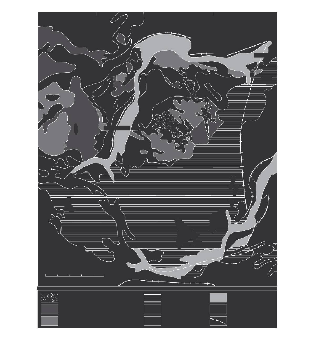
Figure 17.9
Quaternary sedimentary facies of the Ordos Platform and the Loess Plateau, China, showing the spatial relationship
between sand and silt units (simplified from
Geomorphological Map of China and Its Adjacent Area
(scale 1 : 4M), attached to
Chen, 1993).