Geoscience Reference
In-Depth Information
(a)
(b)
Figure 16.4
Aerial photograph of the Escalante River (Col-
orado Plateau) together with Long, Bowns and Explorer
Canyons, which developed by groundwater seepage erosion
(photograph courtesy of Julie Laity).
Not all valleys influenced by seepage erosion will ex-
actly match all of these morphologic criteria (Dunne,
1990). In particular, the amphitheatre valley head and
near-vertical valley sides often considered an essential
Table 16.2
Diagnostic morphometric features of terrestrial
valley networks developed by groundwater seepage erosion pro-
cesses (Howard, Kochel and Holt, 1988).
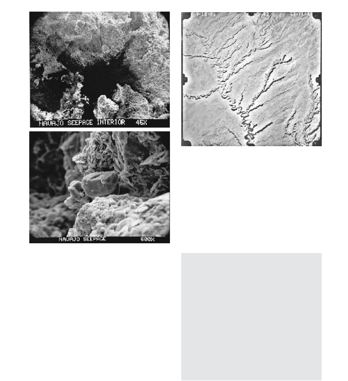
Figure 16.3
Scanning electron micrographs of weathering
features associated with groundwater seepage within the
Navajo Sandstone, Colorado Plateau: (a) macropore develop-
ment within sandstone, (b) small calcite crystal adhering to
a gypsum crystal precipitated within a sandstone pore (micro-
graphs courtesy of Julie Laity).
Morphological characteristics
Abrupt channel initiation, possibly with amphitheatre
valley headwalls
Alcove development with springs or seepage zones in
headwater regions
Steep valley walls with an abrupt angle to a flat valley
floor
Small basin area-to-canyon area ratio
Low drainage density
Long main valley with constant valley width
Short stubby first-order tributaries with a paucity of
downstream tributaries
Possible parallelism of tributaries
Structurally controlled tributary asymmetry
Flat or stepped longitudinal profile
Hypsometric curve with high hypsometric interval,
low hypsometric skewness, negative density skewness
and high density kurtosis
above the valley head, the presence of alcoves and springs
in the headward region (Figure 16.5), steep valley flanks
with an abrupt change in slope angle to a flat valley floor,
a long valley with a constant valley width (Figure 16.4),
short first-order tributaries with possible hanging valleys
and a paucity of downstream tributaries. Analyses of the
hypsometric curve (the area-altitude relationship which
permits the comparison of drainage area and relief for
different systems) for typical terrestrial seepage erosion
networks further indicates that such networks have high
hypsometric interval, low hypsometric skewness, negative
density skewness and high density kurtosis compared to