Geoscience Reference
In-Depth Information
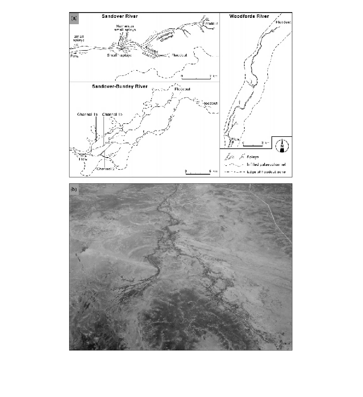
Figure 12.8
(a) Planform sketches of the lower reaches of three ephemeral rivers in central Australia, illustrating the different
downstream changes in channel morphology and the floodouts at the channel termini (from Tooth, 2005). (b) Warburton Creek
in the Channel Country, illustrating the complex landform assemblages characteristic of many Australian dryland plains (flow
direction towards the camera). Muddy anastomosing channels divide and rejoin around large islands, with large palaeomeanders
visible on the surrounding floodplains. Aeolian linear dunes are prominent in the middle right and a single dune is also developed
in mid centre, alongside which a waterhole has developed. The waterhole is hosted in a wider, deeper section of channel, which
divides downvalley into a complex of distributaries and splays, so that defined channels disappear. Bedrock crops out in the near