Geoscience Reference
In-Depth Information
CONGO
0°
GABON
D.R.C.
Kasai
10°
ANGOLA
ANGOLA
ZAMBIA
O
ZIMBABWE
ZIMBABWE
20°
M
NAMIBIA
NAMIBIA
Walvis Bay
Approximate northern
limit of Kalahari Desert
Kalahari Group
sediments
Okavango Delta
Makgadikgadi Basin
SOUTH AFRICA
SOUTH AFRICA
O
M
Hyper-arid
Arid
Cape Town
Semi-arid
0
500 km
10°
20°
30°
40°
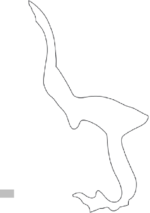
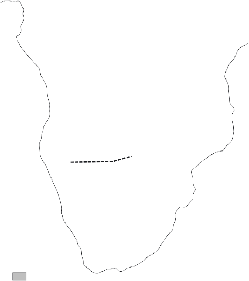
Figure 1.1
The definition of drylands and deserts: the example of the Kalahari. The map shows the distribution of hyper-arid to
semi-arid conditions in southern Africa, overlying the distribution of 'Kalahari Group' sediments (dominated by surface sand units).
The sediments extend north far beyond today's dryland zone, and in part this is testimony to the impacts of environmental and
climatic changes in the Quaternary period. The area referred to as the Kalahari Desert today is broadly coincident with Botswana,
the northwest of South Africa and eastern Namibia. Yet this area is predominantly arid to semi-arid, with hyper-arid ('true desert')
conditions today restricted to the coastal Namib Desert, with the Kalahari largely being moderately to well vegetated. A further
dryland area in southern Africa, the Karoo, is rarely called a desert, yet it is in many respects as worthy of that title as is the
Kalahari
(map based on data in Thomas and Shaw, 1991)
.