Agriculture Reference
In-Depth Information
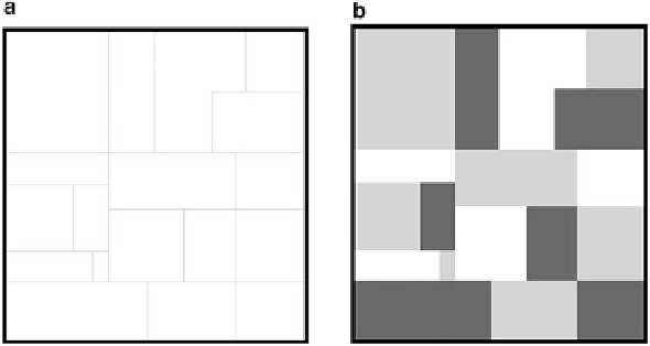
Fig. 4.3 Example of the segmentation and classification of an image
used. For example, if we have used a supervised classifier and the image describes
some fields, the different gray levels could identify three different agricultural
crops.
The classical approach to image analysis only refers to classification as a method
for extracting information from an RS image, and not segmentation. For this reason,
in the following we only describe the main classification procedures for remotely
sensed images.
4.6.1 Unsupervised Classification
Unsupervised methods require a minimum amount of initial information from the
analyst, and are typically based on cluster analysis (Everitt et al.
2011
).
Cluster analysis subdivides pixels in multispectral space using the information
contained in the data that describes the objects and their relationships. Pixels within
a group are similar to one another, and are different from the pixels in other groups.
The greater the similarity within a group, and the greater the difference between
groups, the better or more distinct the clustering. To evaluate the group homoge-
neity, it is necessary to define a similarity measure. The most widely used distance
measures are the Euclidean and city block metrics. Consider the spectral informa-
tion of two pixels x
1
and x
2
. The Euclidean distance is defined as
t
X
M
2
d
E
x
1
;
ð
x
2
Þ¼
ð
x
1
m
x
2
m
Þ
;
ð
4
:
17
Þ
m¼
1
Search WWH ::

Custom Search