Geography Reference
In-Depth Information
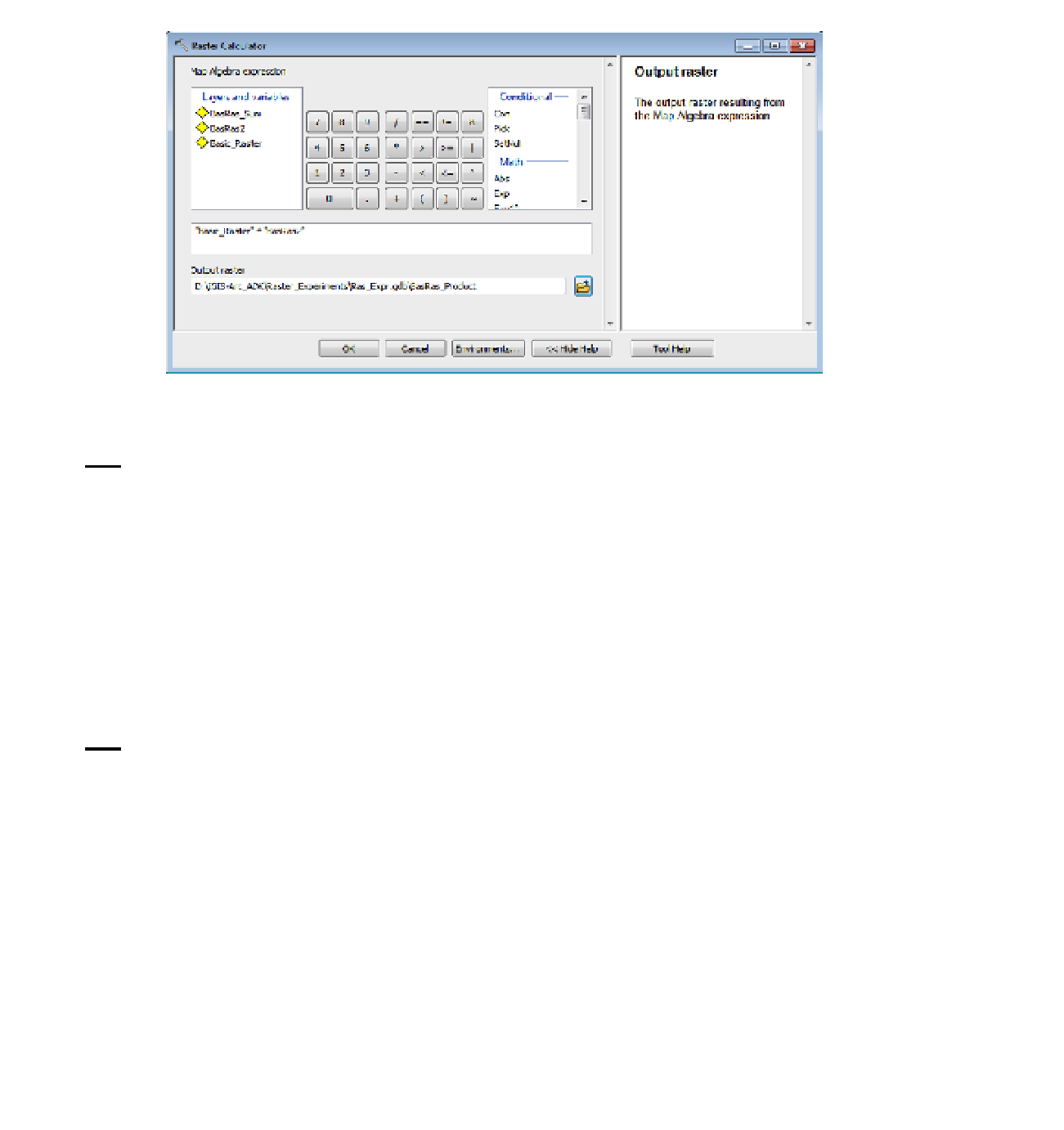
FIGURE 8-39
16.
Use the Raster Calculator again-this time to multiply (use * as the multiplication operator)
Basic_Raster by Bas_Ras_2. Call the result Bas_Ras_Product—making sure, as you will for the
rest of this exercise, that you put it in Ras_Expr.gdb. See Figure 8-39. Use Identify, the T/C,
the CellTool, and the Bas_Ras_Product attribute table to convince yourself that cells contain the
product of the individual values in the two input rasters.
Boolean Operations
Rasters can be produced that indicate “truth values” or Boolean
3
values, in cells. A “1” stands for TRUE.
A “0” stands for FALSE. Suppose you were interested in knowing which cells in Basic_Raster were greater
than or equal to 25.
17.
Calculate Basic_Raster >= 25. “Basic_Raster >= 25” is a statement that is either true or
false, correct? The result, name it True_or_False, will have a 1 (for TRUE) in those cells that
were 25 or more. A zero will appear in the other cells, as you can see from the T/C, the Identify
tool, and the attribute table. (The CellTool may indicate ND for NoData; ignore it.)
The Boolean operators are as follows:
AND (shown in the expression as &),
❏
OR (the inclusive OR, shown in the expression as |),
❏
XOR (the exclusive OR, shown in the expression as ^), and
❏
NOT (shown in the expression as ~).
❏
3
You might wonder why they aren't called Boolian values. It's because the person who developed the concept of
Boolean algebra was George Boole. Fortunately, no one wanted to take the responsibility of changing his name, just to
conform to standards of English.


Search WWH ::

Custom Search