Geography Reference
In-Depth Information
1
1
1
1
1
2
2
1
1
3
3
6
7
Shreve Ordering
FIGURE 8-35 The Shreve method of stream ordering
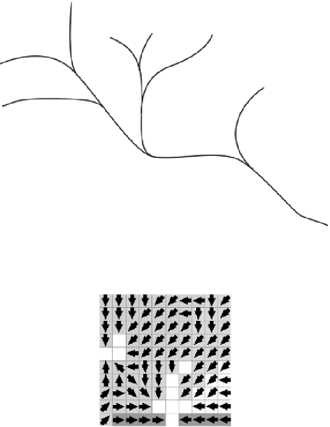
FIGURE 8-36 The five
watersheds correspond to
the five stream links
An outlet, or pour point, is the point at which water flows out of an area. It is the lowest point along the
boundary of the basin. The cells in the source raster are used as pour points above which the contributing
area is determined. Source cells may be features such as dams or stream gauges for which you want to
determine characteristics of the contributing area.
In Figure 8-36, the five watersheds correspond to five stream links. The arrows indicate the direction of
flow from each cell; the cell shade indicates to which watershed the cell belongs.
Another ArcGIS tool that calculates areas that contribute water to a given point is the ArcToolbox
Watershed tool. The distinction between them will be made clear when you work the exercises.


Search WWH ::

Custom Search