Geography Reference
In-Depth Information
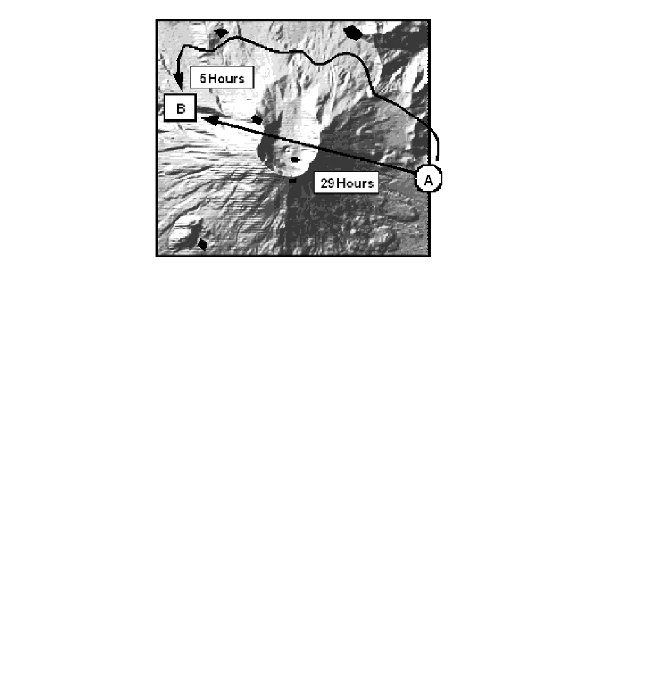
FIGURE 8-14 A straight line, while the shortest, is not
always the fastest
The Cost Distance Mechanism
Spatial Analyst provides the Cost Distance tool for calculating the least cost of getting from any cell to a
source cell. Two input rasters are involved: the source raster and a cost surface raster, each of whose cells
indicate a price of traversing each unit of distance in that cell.
The overall cost of the path from a given cell to the closest source cell is calculated on the basis of
the least-cost path between the two cells. Calculating the total cost involves summing up the costs of
crossing all the individual cells along the least-cost path. The cost of crossing an individual cell is found
by multiplying the distance across that cell by the value found in the geographically equivalent cell in
the cost-surface raster. Thus, the accumulated cost found in the output raster is the sum of the products
formed by (a) the distance across each cell and (b) the value (the “price per unit distance for going
through”) of each cell.
The Cost Distance Calculation
If you want to generate a raster similar to that made by Euclidean distance, but one that will place
in each cell the least cost of traveling from that cell to the source cell, you can use the cost distance
calculation. Cost distance operates with inputs of a source raster and a cost-raster to produce a cost-
distance raster. See Figure 8-15.
The source raster you already know about. The cost raster has darker colors for the cells that it is more
expensive to traverse. The cost distance raster that is formed shows the cost to travel between a given
cell and the source cell. Here the darker color indicates a greater cost in traveling between the source


Search WWH ::

Custom Search