Geography Reference
In-Depth Information
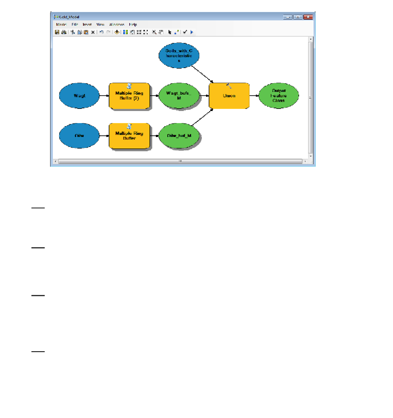
FIGURE 7-21 Partial gold model
12.
Using Pan if necessary, make room on the right for a new tool. In order to clip the union with
the county, add the Clip tool from ArcToolbox > Analysis Tools > Extract. Connect Union_WT_
OW_S_M, identifying it as an input feature in the drop-down menu. Drag in the Getrich_county
feature class. Connect it as the clip feature.
13.
Open the Clip box. Check that the Input and Clip Features are correct. For the Output feature
class, specify Just_Getrich_M. Click OK. Without deleting intermediate data, run the model.
Notice from the dialog box that only the Clip tool is run, since the data needed for it is already
been derived. Close the dialog box. Save the model: Model > Save. Slide the Gold_Model
window out of the way or minimize it. Check out Just_Getrich_M from the Catalog Tree.
14.
Insert the final tool into the model:
Use Select (from ArcToolbox > Analysis Tools > Extract).
Connect Just_Getrich_M to it as the input feature. Right-click the Output feature class, click
Open, and make the name Look_Here_M. Click OK. Open the Select tool, check the input and
output fields, click SQL and create the Expression:
[CHARACTERISTIC] = 'sand' AND [Wagt_areas] = 2005 AND [OilwNG] <> 2500
15.
Verify the expression. Click OK. Click OK. Run the model. Check out Look_Here_M. Congratulate
yourself. Rearrange the model elements so that they look like Figure 7-22. Save the model.
Close the Model. Call your friend.
The friend arrives, looking sheepish. It turns out that, of course, when the miner buried the gold, the units
of measurement were yards, not meters. One yard is 0.9144 meters. So, the distance from the oil wells is
not 2500 but 2286 meters. And the buffers for the wagon trails are at 279 and 1741. Knowing that you
have an easily modifiable model available, you simply smile.


Search WWH ::

Custom Search