Geography Reference
In-Depth Information
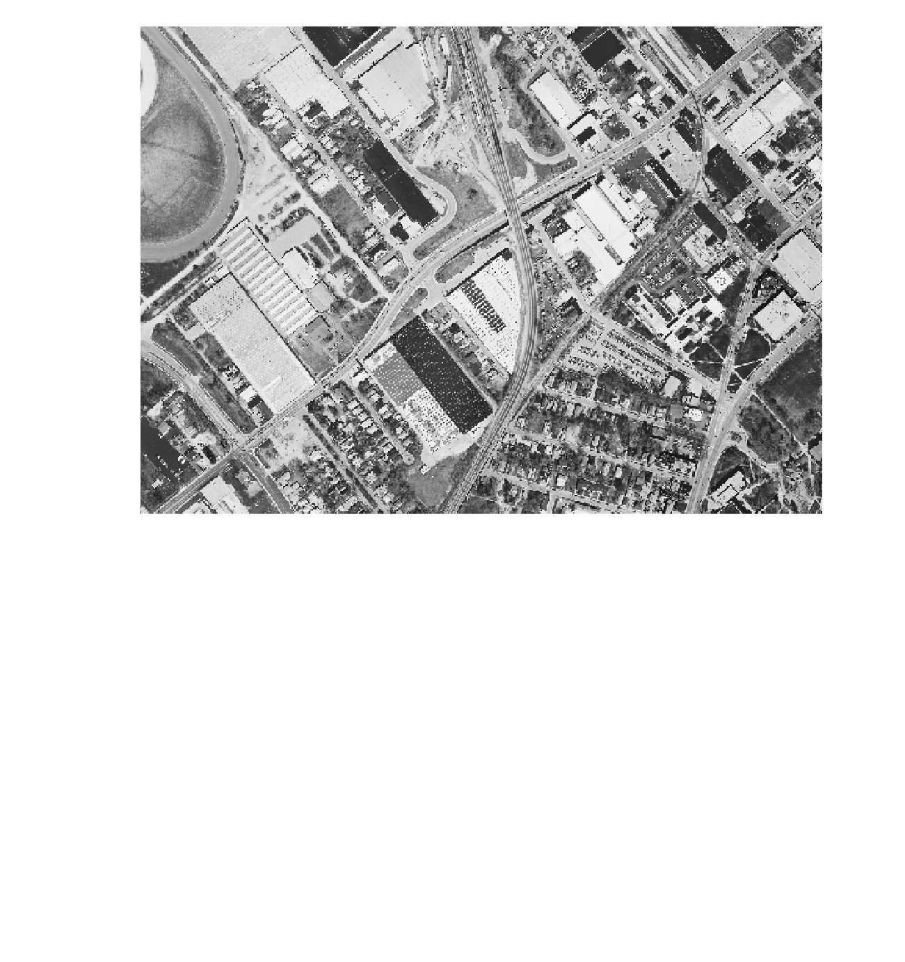
FIGURE 4-2 An orthophotoquadrangle of part of Lexington, Kentucky
❏
WHAT? (entity or quantity)
❏
WHERE?
I don't know how
you
would do this. If you think about it, you may come up with a viable, effective, and
efficient scheme that no one else has thought of. If so, head for the patent office.
Here are approaches that others have come up with:
❏
Systematically divide the overall area up in a regular way into a large number of equally sized
subareas (e.g., small squares). Record what is in each subarea. Have a reference scheme so that you
know where each subarea is. This technique falls under a broad category called
raster
(or
grid
or
cell
).
Almost always, a raster may be viewed as a rectangular space composed of rows and columns.
A given cell is at the intersection of a given row and a given column.
❏
Completely delineate each of the features—“delineate,” in this case, is a real, physical de
line
ation.
It means: in the two-dimensional plane, draw a series of straight-line segments around each area.
Develop a method for determining where the lines are and for giving each segment a direction. This
is often referred to as a
vector
2
approach, since a directed straight-line segment is a vector.


Search WWH ::

Custom Search