Information Technology Reference
In-Depth Information
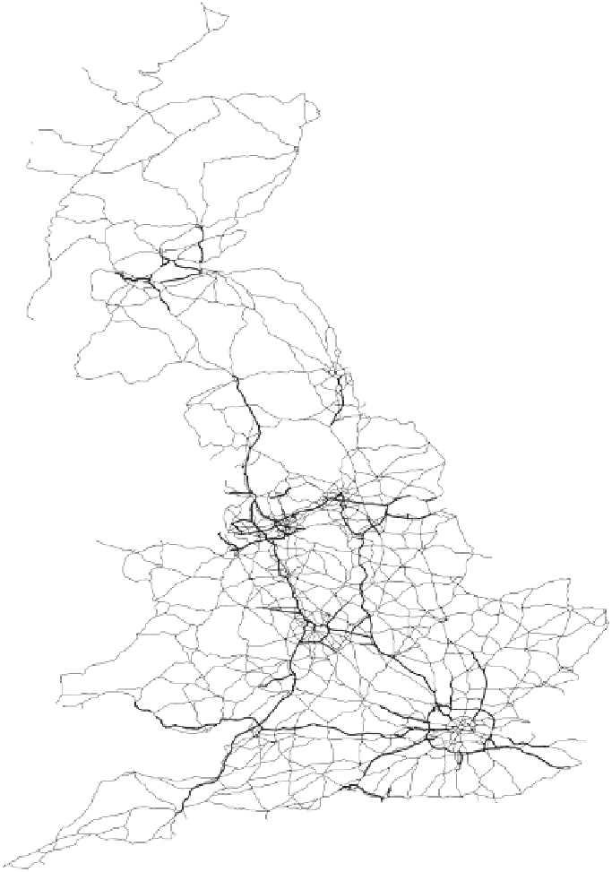
British Primary
Road Network
Equal Area Projection
Figure 3.19 The 1980 motorway and trunk routes taken from the 1:625 000
ordinance survey digital records. The motorway network (in thicker lines) can be
seen to link the major conurbations. The trunk road network covers the space of
physical geography fairly evenly. The two sets of roads look a little like major
and minor arteries serving particular urban areas most densely.
Search WWH ::

Custom Search