Hardware Reference
In-Depth Information
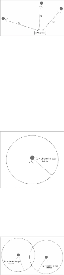
The time delays of the signals
T1
,
T2
, and
T3
can provide the GPS with an absolute posi-
tion using a mathematical process called triangulation. Triangulation works like this: since
the position of the satellites is known, the amount of time that the signal takes to reach the
GPS device is also a measure of the distance between that satellite and the GPS device. To
simplify, let's show an example in two dimensions. If the GPS device knows the value of
the distance to one satellite based on the amount of time delay, you can draw a circle
around the satellite at that distance and know that your GPS device is on that sphere, as
shown in the following diagram:
If you have two satellite signals and know the distance between the two, you can draw
two circles as shown in the following diagram: