Geography Reference
In-Depth Information
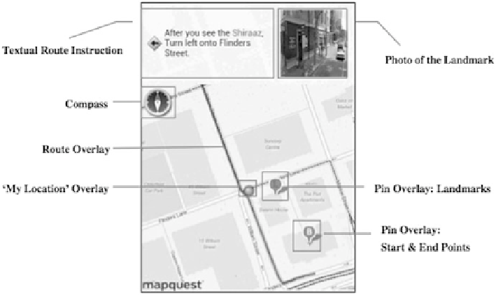
Fig. 6.4
6.2.2
Producing Graphical Landmark References
Now let us turn to producing landmarks in a graphical form. Unfortunately, there has
not been much work done on a dedicated production of graphical landmark displays.
Commercial (in-car) navigation services often depict POIs on their maps, or at least
offer the option to do so. However, as argued before in this topic, they cannot really
function as landmarks. Curiously, while WhereIs produces references to landmarks
in its verbal instructions, the accompanying route map does not highlight these
landmarks. The Bremen kiosk system in one of its iterations depicted landmarks as
part of a multi-modal presentation of route information. But this has been a rather
ad-hoc solution basically labeling those polygons that represent objects mentioned
in the description, while not labeling other object polygons. This research has
never been published or pursued any further. There has been some preliminary
location of a referenced landmark on a moving-dot map as well as a photograph of
this is work in its earliest stages.
is a general discussion not regarding an attached landmark production system.
Their analysis is from a cartographic perspective and provides some guidelines for
including landmarks on a map. In their analysis, they distinguish different ways
of referring to a building, namely either using a shop's name (McDonalds, H&M,
Search WWH ::

Custom Search