Geography Reference
In-Depth Information
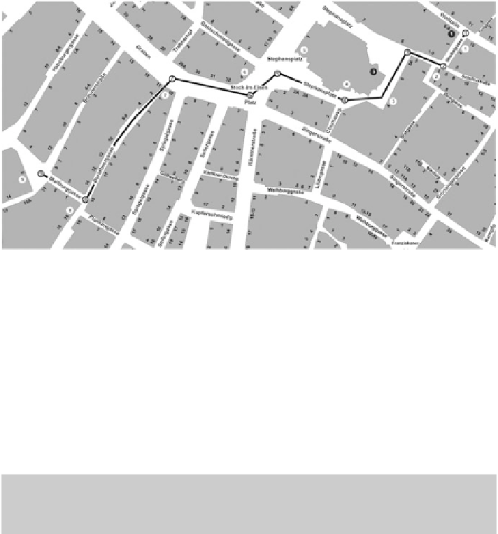
Fig. 5.4
The route investigated in
[
31
]
.
White dots
indicate differing selections between partici-
it turns out that for the given direction of travel, the Bank Austria building has
a higher salience value than the Haas building. Coverage for Bank Austria is
c
D
1, and the orientation is also close to 1, while the Haas building is orientated
nearly completely away from the route. In principle, advance visibility needs to be
calculated for every landmark from every possible direction of approach to cover
for every possible wayfinding situation.
that expands the aspect of structural salience. It accounts for the location of
landmarks along the route and the kind of wayfinding action that needs to
be performed. Since this is route-specific and not a general property of a
Raubal and Winter's formal model has been empirically evaluated by Nothegger,
measures for façade area and shape, color, visibility, and semantic attraction of
a building. Data for one route through Vienna's first district has been collected,
Using this data, for each intersection along the route the most salient landmark
was calculated. These were then compared with the results of a human subject
Search WWH ::

Custom Search