Agriculture Reference
In-Depth Information
70°0'0''W
60°0'0''W
50°0'0''W
40°0'0''W
N
0°0'0''
10°0'0''S
20°0'0''S
Cerrado
30°0'0''S
0
400
800 km
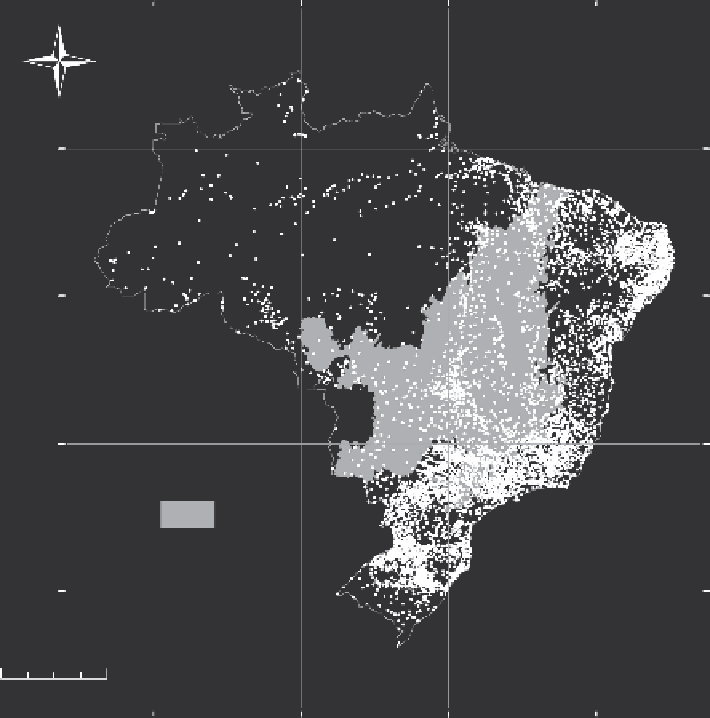
FIGURE 3.1
Map showing the Cerrado biome in central Brazil. Dots represent the 5584
cities of Brazil, mostly located in other biomes. Many cities in the Cerrado are concentrated in
the core area around the capitals Brasília and Goiânia, but human occupation in the Cerrado
is higher only than that in the Amazon basin. (From data available at
www.ibge.gov.br
.
)
development, such as the transfer of Brazil's capital from Rio de Janeiro to Brasília
in 1960, and by a range of tax incentives and land settling programs aimed to stimu-
late agriculture, which had been hitherto restricted to extensive grazing (Sano et al.
2010). These strategic decisions attracted many rural workers from other regions of
Brazil where farmland was too expensive. However, the initial productivity was low
because of the scarce knowledge on climate and soil properties and the lack of crops
adapted to the region. Thus, a major research program was initiated during the mid-
1970s through state-sponsored networks of agricultural institutes (e.g., Embrapa,
Epamig) and land-grant universities. These initiatives created a portfolio of tech-
nologies that dramatically increased productivities of many crops. Currently, the
Search WWH ::

Custom Search