Geoscience Reference
In-Depth Information
seems to have bitterly regretted the loss not only of the ten years in preparing for
and making the expedition but also the ten years of vexation afterwards.
Although by the time the explorers had returned to France in 1744 the issue of the
shape of the Earth was regarded as settled, at least their results were regarded as confir-
mation. Unusually for a campaign organized by the Academy, the principals all pub-
lished individual accounts, presumably because of the breakdown in their relationships
and because of the national differences; it was necessary for the Spanish scientists, for
example, to publish their own independent account to show how their contribution was
of equal status to that of the French. Ulloa's and Juan's account “proved influential in
an unanticipated respect: despite the austerely scientific nature of their enquiries into
geography, geology, hydrography, and climate, they illustrated their work with stun-
ningly beautiful diagrams that incorporated romantic representations of American
landscapes: the first stirrings of what was to be a long story- the nourishing of European
romanticism with images of America” (Fernández-Armesto 2006).
Bouguer's value for the length of the degree of latitude at the equator was 56,768
toises, La Condamine's 56,763 and Juan and Ulloa's 56, 768. Their measurements
confirmed what had become accepted: the Earth was indeed flattened at the poles
and that the Newtonian prediction was correct.
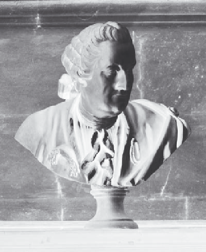
BY THAT TIME the Cassinis had already conceded and agreed that the Earth was a
flattened sphere, the reason being another calculation from the measurement of the
Paris Meridian. Cassini de Thury (Cassini III,
Fig. 26
) went back to basics, deciding
to remeasure Picard's baseline (on which all the surveys depended) and to reduce
Fig. 26
César-François Cassini de Thury (Cassini III). © Observatoire de Paris