Geoscience Reference
In-Depth Information
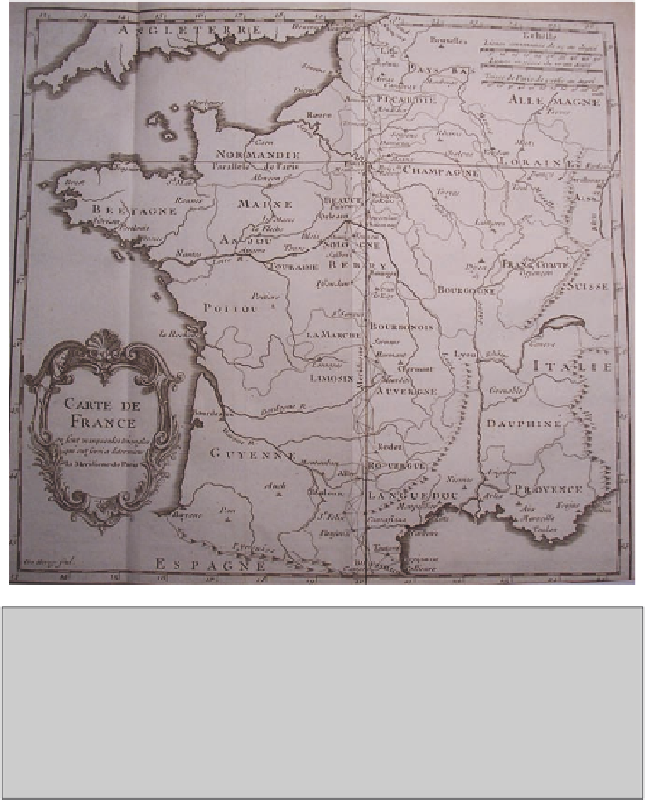
Fig. 14
The meridian of Paris was measured successively in a series of conjoined triangles that
spanned France from north to south, from Dunquerque on the coast of the English Channel near
the border with the Netherlands to Perpignan on the border with Spain. From the measurements of
position and scale that had been made, the geodesists interpolated or extrapolated to fix the meridian
line, which then acted as a fixed line to which the rest of France could be related. A second line
was drawn east-west across France at the latitude of Paris from Brest on the coast of the Bay of
Biscay to Strasbourg on the border with Germany, to provide a second reference axis. These two
reference axes were surveyed repeatedly over the two centuries of the project to map France that
was organized by the Paris Academy of Sciences. César-François Cassini de Thury (1744)
scientific mapping of France. Given the difficulties of the war period and the dis-
organization that followed the change of regime, it was some time before the map-
ping of France restarted. Cassini I had died in 1712 and it was not until 1718 that
the survey resumed, completed by Cassini II, Gabriel-Philippe de la Hire and
Maraldi I, who re-measured along the meridian to the north and completed its
extension from Amiens to the northern coast at Dunkerque.
The north-south axis of the framework that could map France had been firmly
established (
Fig. 14
). In 1733, to establish the second axis, Cassini II (aided by his
son Cassini III) began measuring an arc at right angles to the meridian and running