Database Reference
In-Depth Information
17. Now, as you did for the MapService WMS, test the GeoServer WMS in
QGIS. Create a WMS connection named
GeoServer on localhost
,
pointing to the GeoServer
GetCapabilities
document (
ht-
tp://localhost:8080/geoserver/
ows?service=wms&version=1.3.0&request=GetCapabilities
).
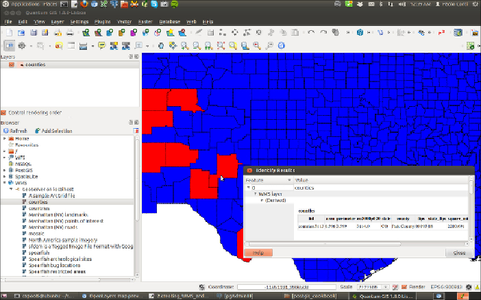
Then,connecttotheWMSserver(forexample,fromtheQGISbrowser),se-
lect
counties
fromthe
Layers
list,andaddittothemap,asshowninthe
followingscreenshot;then,navigatethelayerandtrytoidentifysomeofthe
features:
18. Having used the WMS, try to test a couple of WFS requests. A typical
WFS
GetCapability
request can be executed by typing this URL:
ht-
tp://localhost:8080/geoserver/
wfs?service=wfs&version=1.1.0&request=GetCapabilities
.
You could also click on one of the WFS links on the home page of the
GeoServer web interface.
19. InvestigatetheXML
GetCapabilities
responseandtrytoidentifythein-
formation about your layer. You should have a
<FeatureType>
element,
such as the following, corresponding to the
counties
layer: