Environmental Engineering Reference
In-Depth Information
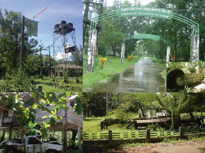
Fig. 6.7
Kasetsart University's Andaman Coastal Research Station for Development preserved
part of the damaged area as a tsunami monument for both remembrance and educational purposes.
Top left
: the signpost indicating the height of the tsunami wave of 6 m (
red arrow
).
Top right
: the
newly built monument's entrance.
Bottom
: the monument area that preserves the damages in the
research center
The university conserved the buildings, vehicles and some scientifi c instruments
that were considerably damaged by the tsunami. A piece of land in the research
center was preserved as a tsunami monument for both educational and tourism pur-
poses (Fig.
6.7
). The partially damaged buildings were restored and have been in
use until now.
At Nua village, the residents used to live in the land properties that overlapped
with those of the ACRSD where both pieces of land belonged to the government.
The overlapping land use caused some confl icts between these communities in the
past. After the tsunami, the ACRSD built fences surrounding the center area, sepa-
rating the land of the center from the land of the Nua village (Fig.
6.8
).
The relocated Nua village was moved to the government land nearby the old area
to the south of the ACRSD. The Royal Thai Air Force built 52 new houses with
funds provided from various sources. It took about 1 year to complete the
construction of the new village. The newly built houses were two-story houses of
which the fi rst fl oor was intended to be a kitchen and the toilet while the second
fl oor contained one bedroom, like a typical Thai government residences (Fig.
6.9
).
Along with the houses, necessary supplies such as clothes, cooking utensils and
Search WWH ::

Custom Search