Environmental Engineering Reference
In-Depth Information
Mangrove Distribution
Simeulue Island
Aceh
N
West Simeulue
Teluk
Dalam
Simeulue Island
Key
Mangrove
East Simeulue
Land
0 0
kilometers
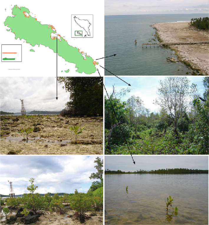
Fig. 19.3
The mangroves in Teluk Dalam, north central Simeulue island have already reached a
coverage of 2,268 stems per hectare due to the relative small uplift (
left
). Larger uplift occurred in
the Eastern side of the island taking the mangroves away from the original intertidal zone resulting
in low level of natural recruitment (
right
) (Source: Blue Forests/author)
have differential tolerances to inundation, a major factor in the apparent zonation of
mangroves from based on substrate elevation (from MSL - HGT).
A transect walk through the mangroves on the seaward edge of “Anak Laut”
lagoon in Singkil reveals the pattern of mangrove mortality and rejuvenation.
Rhizophora apiculata
is dominant at the lowest elevations adjacent to the open
water of the lagoon. As one continues further inland, species dominance changes
with substrate elevation in the following pattern;
Zone 1:
Rhizophora apiculata (
with
Aegiceras corniculatum
in the upper estuary
)
Zone 2:
Brugueira gymnorrhiza
with some
Nypa fruticans
Search WWH ::

Custom Search