Environmental Engineering Reference
In-Depth Information
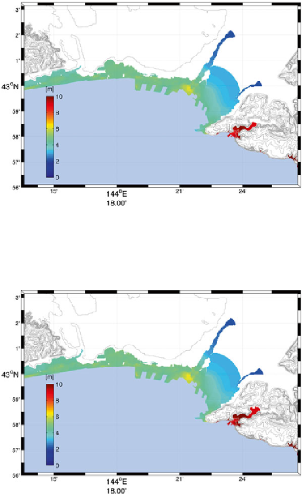
Fig. 11.10
Precomputed tsunami inundation forecast map of the site-specifi c best fault model for
the hypothetical earthquake (Mw 8.7)
Fig. 11.11
Tsunami inundation forecast map directly simulated from the hypothetical fault model
(Mw 8.7) by the numerical forward model
Search WWH ::

Custom Search