Environmental Engineering Reference
In-Depth Information
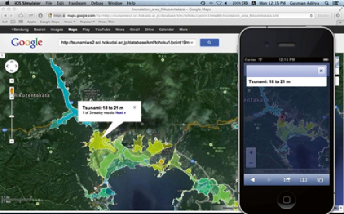
Fig. 11.5
Tsunami inundation forecast map visualized by Google Maps (Source: Google Maps)
11.2.4
Dissemination of the Tsunami
Inundation Forecast Map
The precomputed maximum tsunami inundation maps from all fault models are
exported as Keyhole Markup Language (KML) fi les and stored in the database.
KML is an Extensible Markup Language (XML) notation for expressing geographic
annotation and visualization within Internet-based, two-dimensional maps and
three-dimensional Earth browsers. Google Maps is a desktop and mobile service
application provided by Google Inc. that can visualize the KML fi le. During a tsu-
nami event, the KML fi le for the tsunami inundation forecast map would be uploaded
to a web server so it can be visualized over the Internet by use of the Google Maps
application on a desktop computer or mobile device (Fig.
11.5
).
11.3
Tsunami Source Estimations Based on Real-Time
Observations in Japan
A tsunami can be generated by several types of events, such as earthquakes, volca-
nic eruptions, submarine landslides, or meteor impacts. Earthquakes generated most
of the tsunamis in the world. The input of NearTIF can be an initial sea-surface
deformation by a tsunami caused by any of the events mentioned above. However,
in this paper we discuss only tsunamigenic earthquakes (earthquakes that can gener-
ate tsunamis). In the event of a tsunamigenic earthquake, the earthquake source
Search WWH ::

Custom Search