Geology Reference
In-Depth Information
A survey was undertaken of the area around residence A, with the help
of a penetrometer (soil engineering apparatus measuring the resistance of
the soil: a weight strikes a vertical rod equipped with a calibrated point, and
the number of strikes needed per unit of length to sink the rod is counted).
This investigation gave the following results (see table):
Table 9
Results of the penetrometer survey.
Depth
in cm
0-20
20-40 40-60 60-80
80-100
100-120 120-140 140-160 160-180
S1
1
1
9
45
60 no
passage
S2
1
1
2
10
24
20
42
72
120 no
passage
S3
1
1
2
19
70
89
92
S4
2
3
1
3
24
36
98
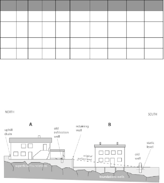
The geologist then studied the area and made the following observations
(Figure 11).
The two residences are built on andesite. Residence A is old, with
superfi cial foundations. It rests on an andesite weathering mantle. Uphill,
the residence is protected by a drain, directing groundwater towards an
old infi ltration well. This well also collects part of the water drained from
the rooftops.
Figure 11
Schematic cross-section of the two residences.
Residence B is founded on piles driven into the andesitic bedrock.
Downhill, an old well contains water. The construction required the creation
of a 2 m talus along the property line. This talus was reinforced with a
concrete wall described in Figure 12.
Search WWH ::

Custom Search