Geology Reference
In-Depth Information
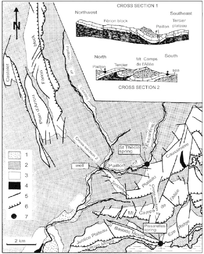
these units show a distinct tilt in their axes and plunge deep below their
Cretaceous cover (100 m of Cenomanian marls, overlain by a thick series
of Turonian marl-limestone) (Figure 120).
Figure 120
Hydrogeologic map of the Jurassic karst aquifer in the Paillon valley (Alpes-
Maritimes).
1-alluvial aquifer, 2-Cretaceous cap, 3-Jurassic karst, 4-Triassic base, 5-major fault,
6-overthrust, 7-karst spring.
Search WWH ::

Custom Search