Geology Reference
In-Depth Information
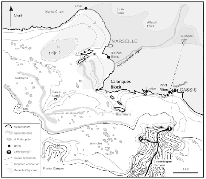
Karst indicators, such as the depth of explored drains at Port Miou or
the presence of a karst paleorelief at a depth of 150 m to the south of the
Calanques (Collina-Girard, 1996), can be explained by a regional base level
more than 200 m deep, below the current sea level. The same is true of the
deep Submarine Cassidaigne canyon off the coast of Port Miou, which has
a karst blind valley morphology and does not connect with any important
continental valley, and could have been formed by the waters of the Port
Miou paleo-spring 250 m deep (Figure 44). The whole area would then
have evolved with a very low base level. Such paleogeographic conditions
were observed during the major evaporation event in the Messinian. The
lowering of the Mediterranean, which induced deep downcutting of the
Rhône and the Durance streams, would have individualised two major karst
systems, Port Miou to the south and Vaucluse to the north (Gilli, 2001). The
Pliocene sea level rise and the accompanying sedimentation of continental
valleys, by blocking deep drainages, forced water to use paleodrains with
near-zero loss of head in order to adjust to the new base level. The marine
Figure
44
Submarine karst relief off the coast of Marseille and the calanques of Cassis (from
Collina-Girard, 1996).
Search WWH ::

Custom Search