Geography Reference
In-Depth Information
Artistic maps
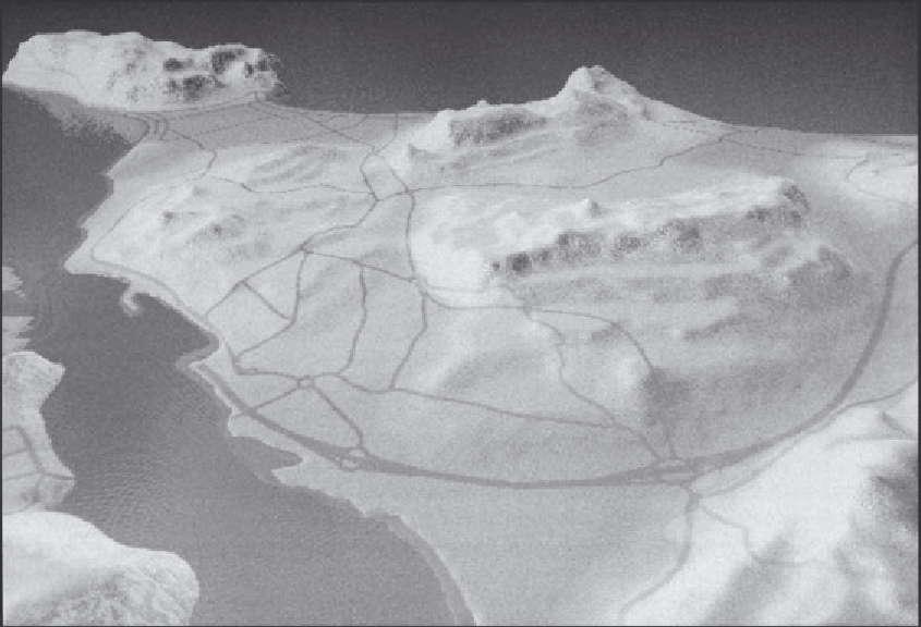
With the growing number of low-cost
multimedia computer systems now available,
together with powerful graphics software, there is
even more scope to create artistic and realistic
representations of the world. Collinson (1997) has
examined the potential to utilise graphics and
landscape visualisation software to create more
visually realistic examples of the world (Figure
41.7).
are essentially a multimedia information resource,
delivering all sorts of different data and
information to a wide end-user base, in a wide
variety of different formats, ranging from text to
images and graphics, video, and sound. Access to
this vast information resource is via the use of a
browser, e.g. Netscape or Internet Explorer among
others, a relatively simple Windows-based
interface, which includes tools to search,
download, cut, copy and paste, display and save
retrieved information, as well as launch other
software applications, e.g. MPEG player,
spreadsheet, graphics software, etc.
Among the different types of data and
information available on the Internet are maps.
The Internet currently offers a considerable
amount of scope for different types of map access
Cartography on the Internet: multimedia
mapping
In recent years, the Internet has evolved very
rapidly. This has since been joined by the Intranet
and the Extranet. The Internet and its derivatives
Figure 41.7
Three-dimensional computer mapping.