Geography Reference
In-Depth Information
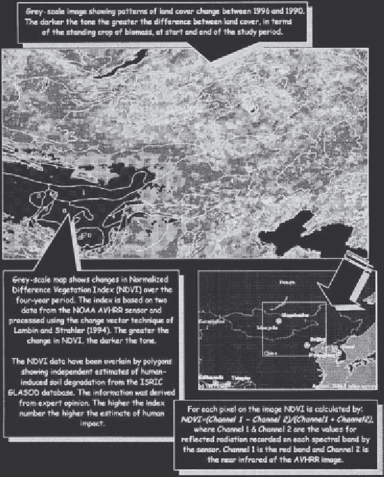
Figure 40.2
Land cover
change in Central Asia.
Source:
NOAA AVHRR data for
calculation of NDVI by Mark
Chopping; GLASOD data from
ISREC, via UNEP; base map
from ESRI, constructed using
online world base map facility.
electromagnetic energy that is reflected or
transmitted by the target. The process is 'remote'
in the sense that we do not have to physically
make contact with the target to find out about it.
Indeed, with satellite systems the sensor can be
many hundreds of kilometres away from the target.
Many different types of sensor are available.
They range from ground-based instruments held
on towers or elevated platforms through to
systems carried on aircraft or satellites. An
introduction to the different types of sensor can
be found in Lillesand and Kiefer (1994). In this
chapter, the potential of remote sensing will be
illustrated by reference to systems carried on some
of the current generation of Earth observation
environmental change. However, it is useful to
highlight three general types, namely:
•
remotely sensed imagery;
•
digital maps; and
•
digital data collected in the field.
We will look at each of them in turn.
Remote sensing
The value of remotely sensed imagery can be
illustrated by looking at the way in which satellite
data can be used to map land cover. Remote
sensing is defined as the process of acquiring
information about an object using the