Geography Reference
In-Depth Information
Box 37.1
The assessment of housing conditions
An applied research task that frequently takes the
attention of geographers and other social scientists is the
assessment and monitoring of housing conditions. This
may be carried out either by means of first-hand field
surveys or, alternatively, by means of the analysis of
census and/or other data, where these have been collated
by the state. These may include planning applications,
data on land subdivisions, water connections and the like.
An example of the latter is provided by the work of the
present author in relation to the small eastern Caribbean
island states (see Potter 1992; 1994; Potter and Conway
1997). Some of the early work on this project involved the
mapping of housing data taken from the census for such
states at the elemental enumeration district level for the
very first time. In recent work, the author prepared a
background paper on housing for the government in
connection with the preparation of the Revised Physical
Development Plan for Barbados, and in this a key input
was data on land subdivisions that were vacant—that is
they had not been built upon and were being held
speculatively, or for future development (Potter 1997).
In the initial work, key housing quality variables such
as levels of ownership, houses over twenty years old,
houses constructed of wood, the use of pit latrines and
drawing water from a public standpipe were mapped for
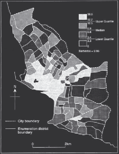
the 121 EDs making up the primate urban area of
Bridgetown in Barbados. An example is shown in Figure
37.2, and the proportion of houses drawing water from a
public standpipe shows a strong degree of concentricity,
being in the upper quartile in respect of the entire inner
city area. A small eastern sectoral wedge is also
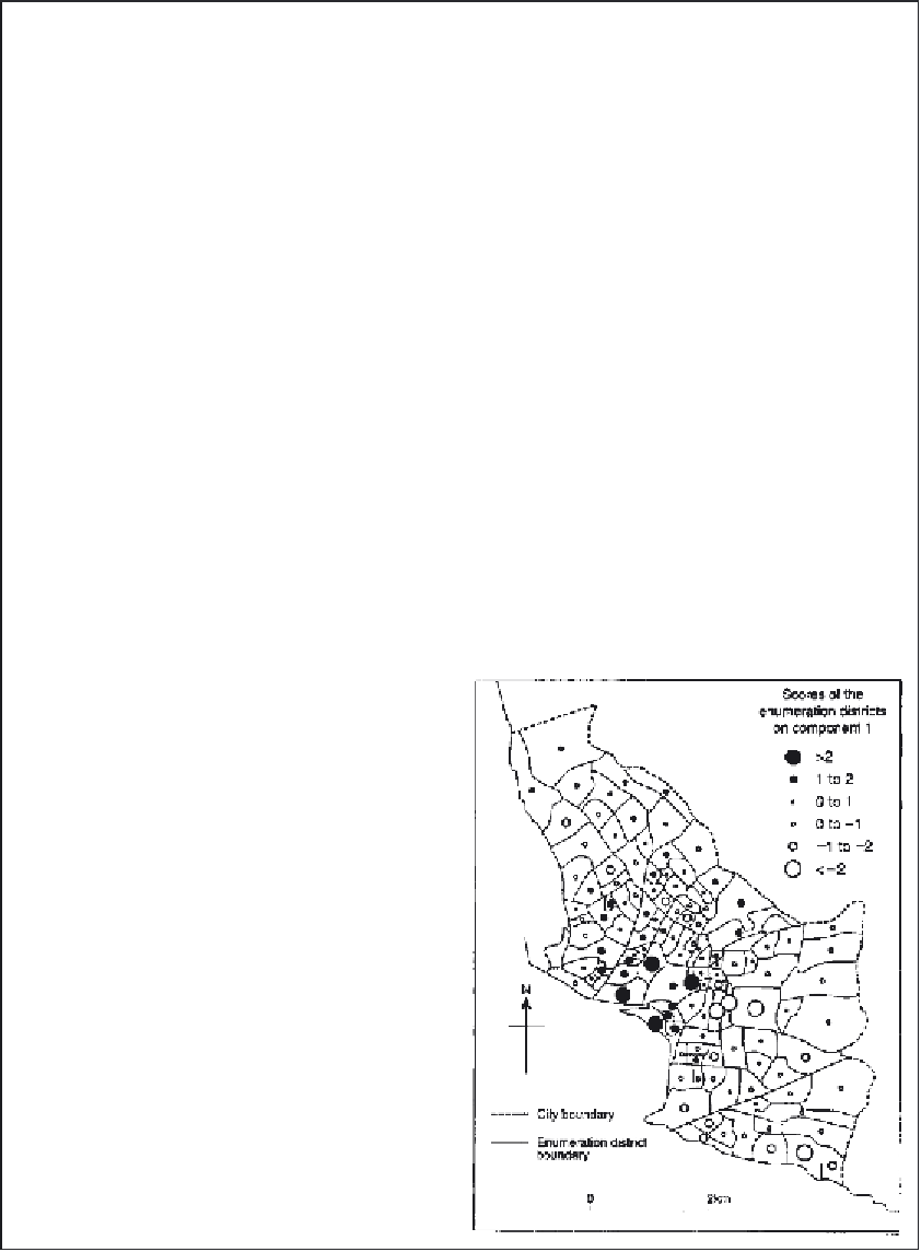
discernible. In the final analysis, the complete data set was
factor analysed. Factor I, a measure of housing disamenity
(Figure 37.3), accounted for 50.3 per cent and showed
clearly the patterning of housing conditions in the city area,
picking out the principal inner city problem areas, where
despite many declarations of intent, no comprehensive
improvement to housing has occurred.
An example of the need for first-hand field
observation in the examination of housing conditions is
provided by Watson and Potter (1997; 1999) although this
example was initially based on rural housing conditions.
In 1980, the residents of what are known as the
'plantation tenantries' were given the right to buy the land
on which their houses were situated. However, in the
meantime, no surveys have been carried out to assess
the degree to which housing on the tenantries has been
improved or upgraded. In an effort to address this specific
issue, over half these housing areas—150 in all— were
sampled. A whole array of characteristics were
considered in relation to each house, ranging from house
form to upkeep, material of construction, foundations,
state of repair, and the visible stockpiling of building
materials such as sand and brick. By such means, a clear
picture of change was built up and analysed at the level
of the entire housing area (Watson and Potter 1999).
Figure 37.2
Percentage of homes obtaining water from a
public standpipe, Bridgetown, Barbados.
Figure 37.3
Scores on Factor I, a measure of housing
disamenity, Bridgetown, Barbados.