Geography Reference
In-Depth Information
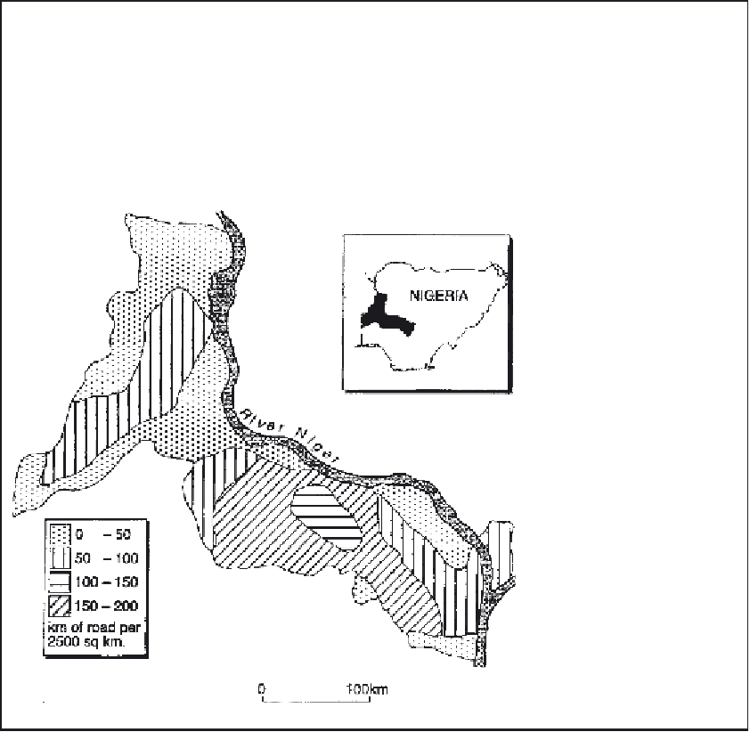
Box 35.1
The measurement of accessibility in the developing world
In the less developed countries of the world, rural
areas are frequently vast in scale and support very
large populations, but have extremely sparse networks
of surfaced (all-weather) roads, and hence there are
severe restrictions on the availability of motorised
transport. In such environments, accessibility has a
completely different meaning to that in the developed
world, and the priorities may be access to clean water
supplies, fuel resources, local markets, schools, clinics
and hospitals. Even where buses can be operated,
they are very infrequent and unreliable; some form of
truck, animal-drawn cart or bicycle may be a more
common means of transport. Suitable methodologies
to deal with this are poorly developed, and data
sources are rarely adequate. Simple distance and
walking times may have to be used. Hence Ogunsanya
(1987) is forced to use road density to indicate
accessibility in a part of Nigeria (Figure 35.1); in the
circumstances, this is not an unreasonable surrogate
for the difficulties in such a region.
Figure 35.1
Accessibility to
motorable roads, Kwara state,
Nigeria. (The population density
of this region is roughly 40
persons per km
2
).
Source:
Ogunsanya 1987.
Service indices and travel times
There are various simple means of assessing
public transport services. Indices of bus or train
service frequency (per day or per week) at
specific locations represent potential mobility, as
they say nothing about access to other places.
'Percentage of villages (or population) with/
without a post office, school, etc.' indirectly
suggests likely problems of local access (Clark
and Woollett 1990; Cloke
et al
. 1994).
'Percentage of population within
x
minutes
travel time of a shopping centre' is a slight
to give 'population potential', which is a basic
simulation of the demand for travel or the 'traffic
potential' for transport operators. Another
variation is to plot the number of opportunities
(destinations such as shopping centres, doctors,
etc.) within
x
km, or
x
minutes travel time, via the
network, from each origin point. Suitable
modifications can deal with a variety of situations,
e.g. Joseph and Bantock (1984) on accessibility to
doctors in Ontario, Canada. Network-based
techniques are aggregative, 'geometric' measures
more suited to the regional scale.