Geography Reference
In-Depth Information
limitations imposed by culverts or old bridges on
suburban streams. The flooding may last from
twenty minutes to a few hours.
Snow melt flooding:
seasonal snow melt river
regimes occur on many rivers draining mountain
regions, such as the Rhine, Rhône and Danube in
Europe. While these annual high water levels are
usually coped with well, exceptional combinations
of weather conditions can produce high volumes
of warm rainfall, which cause extremely rapid
snow melt, creating disasters like those that
affected the Guil valley in the French Alps in 1957,
when whole villages on old alluvial fans were
destroyed.
Catchment-wide flooding from prolonged heavy rain:
usually produced in the UK by depressions
whose passage is blocked by immobile high
pressure to the east; these drop large volumes of
water over a wide area, causing rivers to burst
their banks and flood large areas. This is the type
of flooding affecting the River Severn and the
River Mersey about once every two to three
years (Plate 9.1). In tropical regions, this would
be associated with the passage of typhoons
(hurricanes or cyclones) or disturbances within a
monsoonal air flow. The flooding lasts from a few
hours to two or three days, depending on
catchment size.
Urban areas often experience localised flooding
through poor design and planning of
developments, or simply through the thoughtless
throwing of debris into small streams, as when in
Manchester a mattress and other debris blocked a
culvert entrance and caused the flooding of an
adjacent housing estate. An undersized drain at
Llandudno Junction, Wales, caused thirty new
houses in a small flood basin to be flooded to a
depth of 1 m by the Afon Wydden in both
October 1976 and February 1977 (Parker and
Penning-Rowsell 1980).
The classic method of regulating streams and
rivers in cities was to either turn them into
concrete or stone culverts, or embank them, as
along the Rio Guadelmedina at Malaga, Spain
(Plate 9.2), or divert them around city centres.
Since 1980, much attention has been paid to
designing rivers for multiple use, with both
adequate flood storage and control and with major
environmental benefits. Attempting to 'tame' any
natural alluvial river is now seen as undesirable
(Thorne 1998). Single-purpose levee and
channelisation projects exclude other possible uses
for stream and flood plains, such as preservation of
riparian woodlands, creation of greenways for
urban parks, conservation of stream fishery habitat,
and storage of flood waters in floodplains (Riley
1998). In the USA, complex overlapping federal,
state and municipal responsibilities have often led
to slow decision making about stream channel
improvement, but now participatory, multi-agency
'watershed councils' are often proving effective. In
Portland, Oregon, the city council adopted a
management plan with objectives ranging from
Regional flooding:
usually produced by an
unusual combination of prolonged rain over a
large, already wet area: typical of the floods
that have occurred in the Mississippi and its
tributaries in recent years, the most severe
floods on the great rivers of Asia, and the
floods that take weeks to pass down the
Murray-Darling river system in Australia.
Towns in the path of such floods can expect
widespread inundation lasting for many days to
two or more weeks.
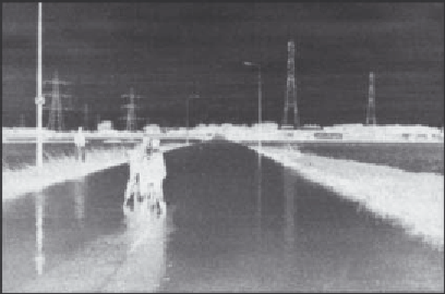
Plate 9.1
Flooding of Flixton Road, Carrington, Greater
Manchester, in December 1991 as a result of catchment-
wide flooding from prolonged heavy rain.