Geology Reference
In-Depth Information
associated with continental rift zones
such as the African rift valley. There
are characteristic differences in the
type of lava emitted from these volca-
noes - oceanic vulcanicity is typically
basaltic whereas that associated with
the circum-Pacific and Indonesian belts
is dominated by
andesitic
vulcanicity.
The reasons for both the distribution
and the compositional difference are
explained by the plate tectonic theory to
be discussed in the following chapter.
and volcanic signatures, but less
intense movements can be recorded
well away from these belts anywhere
on the Earth's surface. These move-
ments are generally not accompanied
by earthquake activity, that is, they are
aseismic
and show both horizontal
and vertical movements of the order of
millimetres to centimetres per year.
Relatively recent vertical movements
of the land surface relative to sea level
can also be studied by observing the
positions of
raised beaches
(e.g. Figure
2.7) and buried forests. This evidence
shows us that since the last (
Pleisto-
cene
) Ice Age, the land surface of Scot-
land and Scandinavia has been uplifted
due to the slow recovery after the release
of the weight of the ice sheet. In the case
of Scandinavia, the old shore-line has
been uplifted into a dome-like shape by
up to 250 metres (Figure 2.8); this gives
average uplift rates of up to 10 millime-
tres per year. Larger post-glacial uplift
rates for Iceland have been calculated
in the range 2-9
centimetres
per year.
Movements of this type character-
ise broad areas of the crust between
the major tectonic belts that may be
regarded as stable, in contrast to the
instability of the seismic zones. Over
long periods of geological time, stable
zones (termed
cratons
) can be recog-
nised separating the relatively unstable
belts, sometimes known as
'mobile'
belts
. Thus, at any given time in the
geological past, or at least back to the
later
Archaean
, a distinction can be
made between cratons and mobile
belts that, as we shall see, can be
explained by plate tectonic processes.
2
8
9
Aseismic tectonic activity
Crustal movements currently taking
place can be measured by repeated
recording of location and height using
sensitive instruments. The larger and
more obvious movements are associ-
ated with the major tectonic belts
already recognised from their seismic
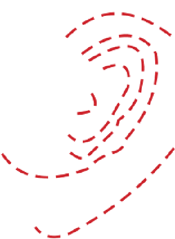
Figure 2.8
Post-glacial uplift
of Scandinavia. Contours,
in metres, representing the
uplift of the Baltic area based
on the present-day positions
of post-glacial raised beach
deposits. The shape of the
uplift approximates to an
oval dome; the centre of the
dome, where the ice sheet
would have been thickest, has
been uplifted by 250 m. After
Zeuner (1958).
50
100
150
200
250
250
50
200
100
150
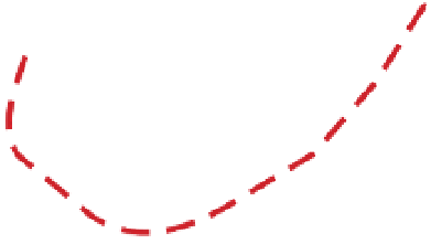
Figure 2.7
Raised beach. The wave-cut platform in the
foreground on which the castle now stands has been raised
about 5 m above present-day sea level due to post-glacial uplift;
the raised beach is backed by a cliff that would have originally
represented the shore line. Lismore, Argyllshire, Scotland;
IPR/73-34C British Geological Survey © NERC.
0
200
km


Search WWH ::

Custom Search