Geography Reference
In-Depth Information
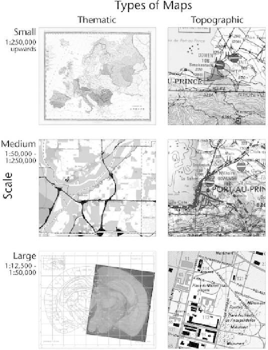
Types of Maps
Three of the most common types of maps are thematic, topographic, and
cadastral. There are many ways to develop typologies of maps, but these
three types seem to distinguish both how and why maps are used.
Thematic
maps
are the most common: they show specific topics and their geographic
relationships and distributions. Thematic maps show us the weather fore-
cast, election results, poverty, soil types, and the spread of a virus.
Topo-
graphic maps
—from the United States Geological Survey (USGS), for exam-
ple—show the physical characteristics of land in an area and the built
changes in the landscape.
Cadastral maps
show how land is divided into real
property, and sometimes the kinds of built improvements. How each type of
map is made with geographic information is a question that you will be able
to answer generally at the end of Part 1. You can find out about the specific
Maps are generally distinguished by scale and whether they are thematic or topo-
graphic in nature. Each type shown here is characterized by different geographic representation
and cartographic representation choices.


Search WWH ::

Custom Search