Geography Reference
In-Depth Information
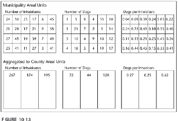
countries, or states, but they can also be an archaeological site, biotope, or
watershed. It is of course possible to aggregate the data from one type of
geographic unit to a larger unit (e.g., counties to states), but different areal
aggregations might result in very different representations, supporting very
different conclusions. When creating a choropleth map, it is very important
to state which geographic units were used for collecting the data (see
Plate 8).
In urbanized areas and for environmental applications that rely on
administrative or arbitrary boundaries, these issues are of special importance.
These boundaries frequently can divide communities or congruent zones—for
example, a lake in the middle of a desert. While the water is regionally
significant, the lake should only have minute influence on the statistics of
a largely desert area. However, if most of the lake ends up in a small town,
taken by itself, it may look like the town has rich water resources to itself.
TYPES AND APPLICATIONS OF COMMON CLASSIFICATIONS
Equal Interval.
The equal interval classification divides the total range
(the number between the minimum value and the maximum value) into
equal parts. This classification is best used for properties of things and
events that have an implicit order—for example, the top 30 stores by sales in
the state. This classification is valuable for highlighting such an order, but
can mask details and deviations.
Areal aggregation of geographic units can lead to results that mask important
geographical characteristics and relationships.

Search WWH ::

Custom Search