Geography Reference
In-Depth Information
Calculating map scale using a known distance on a map or visualization.
Use of known features
•
Use of lines of latitude or longitude
•
Use of map object comparison
•
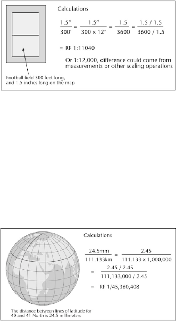
The use of known features uses the ground distances that are clearly
known for an object on the map or visualization. Based on the measurement
of the distance on the map for the same feature, the map scale can be easily
calculated. Because of distortions of paper or minute measurement error,
often the results may be slightly in error.
The known distances between lines of latitude or longitude can also be
used to determine scale. This approach is especially suitable for small-scale
Determining map scale using the distance between lines of latitude or longitude.


Search WWH ::

Custom Search