Geography Reference
In-Depth Information
rowly understood, as a discipline, surveying is the regulated methods, tech-
niques, and procedures of position determination for legally regulated activ-
ities, engineering, and other activities requiring certifiable accuracy.
Surveying is also known as geodesy in many areas, especially when very
recent technologies have become a mainstay of the surveying.
We can define surveying as the systematic collection of positional loca-
tion and other location-related characteristics. It is an organized activity
using known coordinate systems and procedures for attribute collection
based on geographic representation and cartographic representation. The
collection of positional and attribute information in the field must resolve
the problems of reducing measurements from the infinitely complex earth
to observations that correspond to the geographic representation and carto-
graphic representation.
Advanced surveying to fulfill the needs of construction and legal
requirements is a very specialized discipline. Technologies and methods
define the practices of surveying; laws and regulations define the standards
and practices.
Brief History of Surveying
Even without telescopes, tape measures, or lasers, ancient surveyors could do
work of astonishing accuracy. The pyramids in ancient Egypt are evidence of
that accuracy which exemplifies the advancement of Egyptian surveying.
Even older map fragments found in Mesopotamia (modern Iraq) point to
that society's advanced surveying techniques. Even if we can only puzzle over
the construction of neolithic monuments in Stonehenge, Easter Island, and
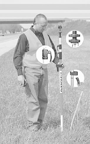
Professional surveyors need high-accu-
racy equipment such as this prism pole, which reflects
the laser light used in detailed surveys.
Photo courtesy of Crain Inc.


Search WWH ::

Custom Search