Geography Reference
In-Depth Information
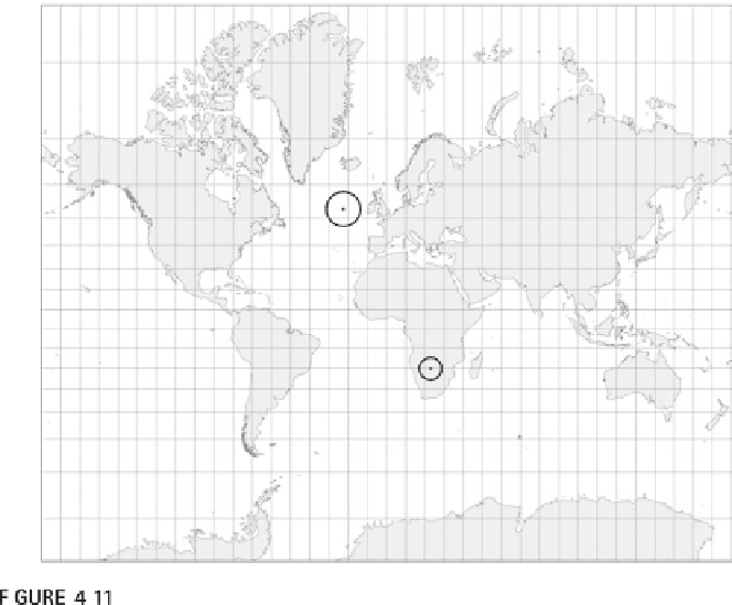
Two Tissot indicatrix circles shown on a Mercator projection with the standard line
of the equator.
different sources. Projections for GIS provide a great deal of f lexibility, but
also introduce problems when working with different projections. You
should note that projections used for geographic information differ from
maps in an important way. When a map is made one single projection is used
with a single scale for the entire map. The same thing applies for geographic
information with one important difference: the coordinate system of the
geographic information usually is much larger than a piece of paper used for
a map. The geographic information must be scaled another time when a
map is made, which can introduce some distortion. Obviously, if the geo-
graphic information is stored in the coordinates of a piece of paper, it is
much harder to use it with other data, so this makes sense.
The assumption that the geographic information for the same area uses
the same projection can lead to vast problems. Usually the problems when
combining geographic information from different projections are so obvious
that they can't be missed. Sometimes the distortions are slight and may seem
inexplicable: a road from one data source is 2 m away from the property that
runs along it from another data source. If care is not taken, it is possible to
create great errors by combining data prepared from different projections.
The same applies to coordinate systems, the topic for the next chapter,
where we will look at these issues in more detail.

Search WWH ::

Custom Search