Geology Reference
In-Depth Information
Figure 4.34. A view of the Hadley Rille wall photographed by the
Apollo 15 astronauts, showing a cross-section of at least three
basaltic lava
flows, overlain by fragmental regolith and talus
deposits on the lower slopes; these are the only outcrops visited thus
far in the exploration of theMoon; theMontes Apennines are visible
on the horizon (NASA H-12115).
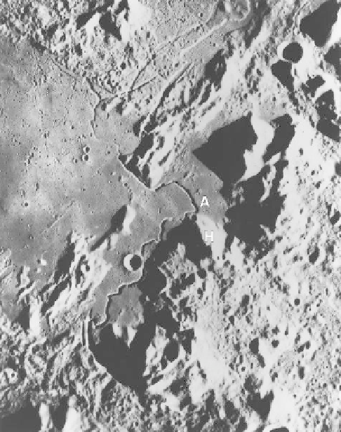
Figure 4.33. A view of the Hadley Rille, site of the Apollo 15 landing
site (A). The Montes Apennines (H) form the rugged terrain on the
right and are part of the ring structure for the Imbrium basin (the
area shown is about 60 km by 100 km; morning illumination is from
the right; NASA AS 15
-
0414).
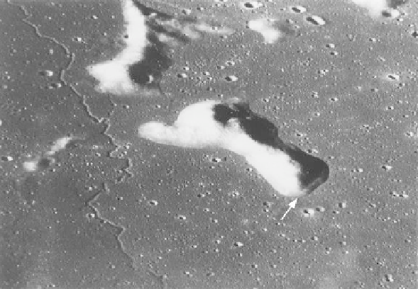
Figure 4.35. The terrace, or bench (arrow), at the base of
this hill is thought to represent a high-standing mark of
the mare lavas, the surface of which was subsequently
lowered by drainage through lava channel(s), degassing,
or a combination of these processes. In this oblique view
of the Hergonius region, the near-
eld view is about
30 km across (NASA 16
-
19140).
highland terrains, and many are found in mare deposits
that contain sinuous rilles (
Fig. 4.35
). Some benches are
20m high and can be traced for several kilometers. The
benches probably represent high-stands of the lava
ows
that subsequently drained downslope, possibly aided by
flow through lava tubes and channels. However, degass-
ing of the basalts during cooling could also contribute to
the lowering of the mare surface. Some of the Apollo