Geology Reference
In-Depth Information
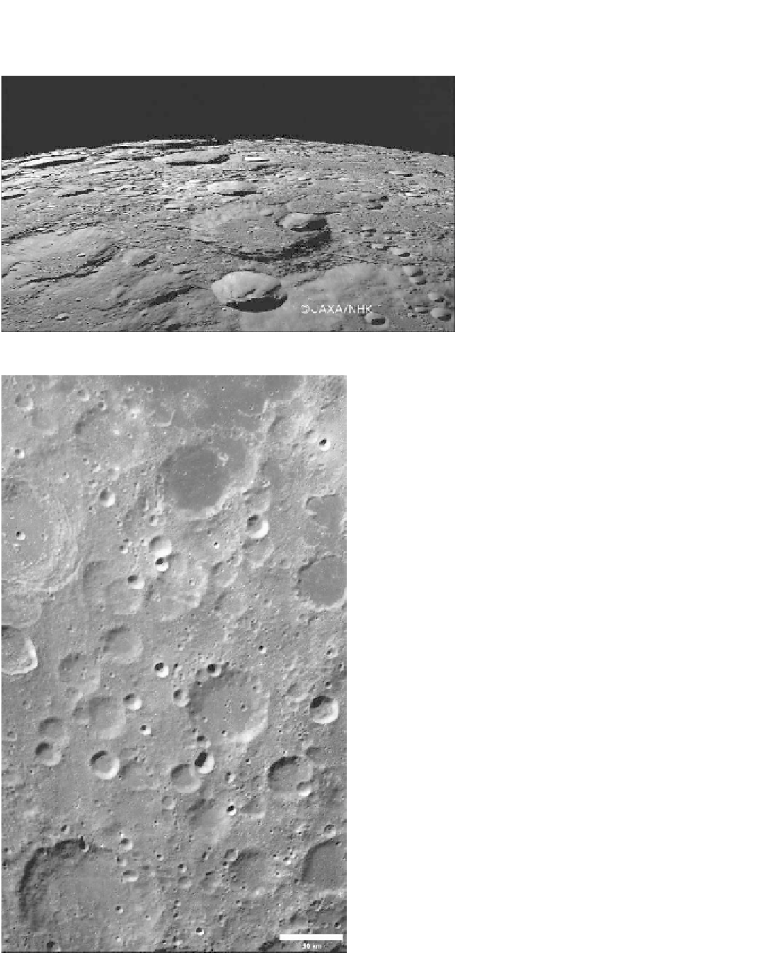
Figure 4.17. An oblique view across the lunar
north polar cratered terrain obtained by the
Japanese Kaguya spacecraft. The smoothly
rounded appearance of the terrain results from
repeated bombardment by impacts of a wide
range of sizes, re
ecting the effectiveness of
impact as an agent of surface modi
cation by the
erosion of high-standing areas, such as crater rims,
and
filling-in of low areas, such as crater
oors
(© Japan Aerospace Exploration Agency [JAXA]).
11 instruments that included contributions from NASA,
such as the Moon Mineralogy Mapper for which Carlé
Pieters of Brown University was the PI. The spacecraft
also carried the Moon Impact Probe, which was released
to crash into Shackleton Crater in the south polar region to
provide signs of water. The mission was ended in August
2009 when various components failed to operate, prob-
ably due to overheating when the spacecraft was in full
sunlight.
NASA
'
s return to the Moon in the twenty-
rst century
beganwith the launch of the Lunar Reconnaissance Orbiter
(LRO) in June 2009. Although its primary goal is to return
detailed information to support ambitious human landings,
its payload is yielding a wealth of data of direct scienti
c
interest, including altimetry, remote sensing data, and high-
resolution images under the direction of Mark Robinson at
Arizona State University. In addition to mapping the Moon,
NASA
'
s lunar missions included LCROSS (Lunar Crater
Observation and Sensing Satellite), which used cameras
and spectrometers to watch the impact of its upper stage
in the south polar region. The resulting crater was 28m
across, and the impact formed an ejecta plume in which
clear evidence of water was revealed.
In the past decade, there has been a growing body of
evidence that substantial amounts of water are present on
the Moon. Many of the recent lunar missions involved
crashing objects onto the surface to observe the resulting
impact ejecta to detect signatures of water, while instru-
ments on orbiters have been used to map the presence of
hydrogen and hydroxyls as surrogates for water. Global
mapping from Chandraayan-1 shows that such signatures
increase toward the poles, as expected for water implanted
by comets into permanently shadowed craters, but,
in addition, occurrences elsewhere suggest chemical
Figure 4.18. One of the
first image mosaics produced from
Chang
s lunar orbiter, which began operation in late 2007.
The area shown covers mostly highlands of the south polar region
and includes part of Mare Australe (upper right). This mosaic consists
of 19 images of resolution about 120m per pixel.
'
e1, China
'