Geology Reference
In-Depth Information
The second style is cryovolcanism, involving melted and
partly melted ice, or slush. When the low-resolution Vo y a g e r
images showed Europa
'
s young terrains, it was suggested
thatithadbeenresurfacedwith
floods of water by cryovol-
canic processes. While this might account for some of the
bright plains, much of the surface is more the result of
tectonic deformation. Nonetheless, small inferred
“
ice
ponds
”
(Fig. 8.23)
, chaotic terrain, in
lling of spreading
center bands, and features called lenticulae appear to involve
intrusion and extrusion of melted or partly melted ice.
Lenticulae average about 10 km in diameter and include
pits, dark spots
(Fig. 8.24)
, and domes where the surface is
upwarped and commonly broken. These features could
form by up-welling of compositionally or thermally buoy-
ant
ice diapirs through the ice shell
(Fig. 8.25)
.As
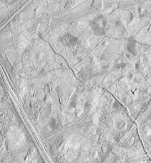
Figure 8.23. Some local areas of Europa
s ridged plains appear
ooded, as suggested by the smooth,
at area in themiddle-left part
of the picture. The smooth area is 3.2 kmacross andwas cratered by a
small impact. The area shown is 11 km by 16 km (NASA Galileo
PIA00592).
'
Figure 8.24. Many Europan domes are either dark or have associated
dark patches, which might be non-water materials brought to the
surface from below the ice crust. The area shown is 130 km across
(NASA Galileo PIA00588).
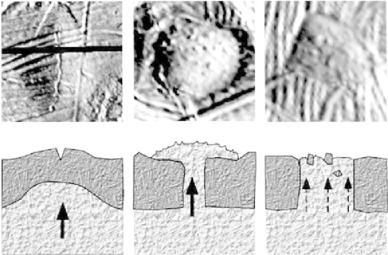
Figure 8.25. Galileo images and
corresponding diagrams
showing ways in which
lenticulae might form. Left: a
plume of warm ice or liquid
water rises, buckling the surface;
middle: a blob of low-density
material breaks through the
crust and
flows onto the surface;
right: local heating melts
through the ice crust.