Geology Reference
In-Depth Information
(a)
(b)
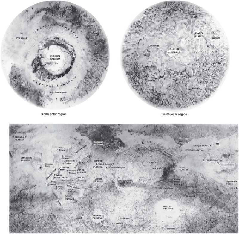
Figure 7.1. Shaded relief
maps of Mars showing
albedo patterns for the
polar regions (a) and the
equatorial regions (b) with
selected place names and
the locations of the
successful landings. By
happenstance, the
rst
three NASAmissions toMars
(Mariners 4, 6, and 7) were
all
flybys that imaged only
the heavily cratered
southern highlands, leading
many to think that Mars was
much like Earth
'
s Moon.
renewed interest in Mars, especially with the proposal
(now largely rejected) that one of the Mars meteorites
contained evidence of life. NASA implemented an expan-
sive program for Mars exploration involving landers,
orbiters, and roving vehicles, which continue to provide
an incredible wealth of data, despite notable spacecraft
failures by NASA, Russia, Great Britain, and Japan.
Key recent missions include the NASA orbiters Mars
Global Surveyor (MGS) with its Mars Orbiter Camera
(MOC), Thermal Emission Spectrometer (TES), Mars
Orbiter Laser Altimeter (MOLA), and instruments for
measurements of the remnant magnetic
field; Mars
Odyssey with its Thermal Emission Imaging System
(THEMIS); and the Mars Reconnaissance Orbiter
(MRO) with its High Resolution Imaging Science
Experiment (HiRISE) and the Compact Reconnaissance
Imaging Spectrometer for Mars (CRISM); and the ESA
'
s
orbiter Mars Express with its High Resolution Stereo
Camera (HRSC) and near-IR spectrometer, OMEGA.
In addition to the images from these missions,
topographic information from MOLA, the HRSC, and
HiRISE is particularly important for geomorphic studies
of Mars. The global altimetry from MOLA enables broad
views of the planet to be generated from its digital eleva-
tion model (DEM) and assessment of regional slopes. The
local DEMs derived from stereoscopic images enable
topographic resolutions as good as a few meters for
selected areas.
Successful landings in the same period include the
Mars Exploration Rovers (MER) Spirit and Opportunity
(Squyres et al.,
2003
), operating concurrently in two
different regions of Mars and returning in situ data on
surface compositions, physical properties, and active sur-
face processes, and Phoenix, which landed in the north
polar region, returning de
nitive evidence of water-ice on
and near the surface. All of these spacecraft include instru-
ments in addition to those noted here (such as the radar
sounding systems on Mars Express and on the MRO) and
have provided unparalleled information on Mars, much of
which has yet to be
“
mined
”
by the science community.
the


