Geography Reference
In-Depth Information
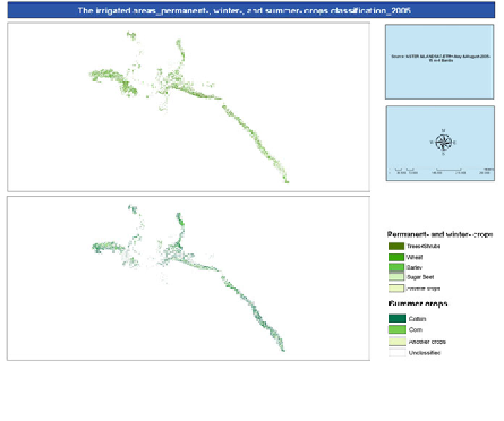
Fig. 6.8 The classification of the major permanent, winter and summer irrigated crops within the
irrigation projects in the ERB for the data of TERRA-ASTER and LANDSAT-ETM+ acquired in
May and August (2005)
bands, to decrease the time of classification. Hence, participation of these bands
became a negative factor regarding to the time taken required for classification.
An error was also detected in classifying some constructional areas as well as
some limited areas from the bare areas considered as fallow lands (Fig.
6.8
).
Sugar beet was perfectly classified. Other crops classes were broken in form of
lines among fields, either in the shape of trees, shrubs, bushes and fences, or as
natural plants and crop residues.
The spectral mixture between wheat and barley was found mostly in the higher
areas of the ERB (fortunately, the cultivation of irrigated barley is rare here), while
further down the basin in the Deir Azzour governorate, the spectral separation ratio
was reported as good because the majority of irrigated barley is a pastoral barley.
There was no large difference in the spectral separability and discrimination
between the various agrarian crops in areas featuring irrigation projects and large,
organized fields, either using the TM-data with spectral resolution of six bands and
spatial resolution of 30 m, or the ASTER/ETM+-data with the same spectral
resolution and a higher spatial resolution of 15 m. There was also no significance
in obtaining or using sensory data of larger spatial resolution than 30 m; conse-
quently, the negatives of this were the increases in time, cost and effort. The
ASTER-data with the spectral resolution of three bands and a spatial resolution of
Search WWH ::

Custom Search