Geography Reference
In-Depth Information
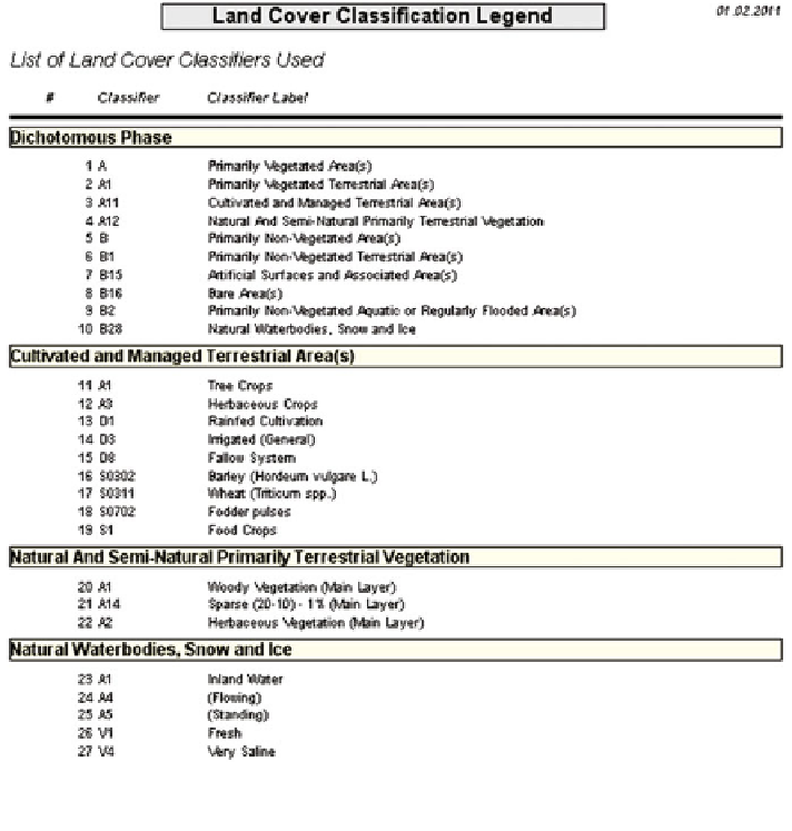
Fig. 5.40
LULC-classes that generated from the LCCS-software (version-2) for the four regions
study area
(Fig.
5.43
) fused with additional three spectral bands of LANDSAT: ETM+/SLC-
Off-corrected/-May-2005/15 m (Fig.
5.44
). Two supervised classification
approaches (Multi Stage Classification Approach and One Stage Classification
Approach) were adopted, using the three supervised classification algorithms
MLC, ANN and SVM. This comparison study was carried out for the selected sub-
study-area of the four administrative regions. The LULC-classes generated in
relation to the selected testing area based on the LCCS-classification scheme, are
described in Fig.
5.40
.
An evaluation of the presented results was performed to define and confirm
which classification approach and/or classification algorithm was optimized for the
sub-study area and for the greater study area of the ERB. Two methods were used
in the evaluation. The first (Fig.
5.45
) was qualitative rather than quantitative,
more manual, and used non-remotely sensed data (human-based data) as truth-
reference for measurement of the accuracy of the produced thematic maps results.
Search WWH ::

Custom Search