Geography Reference
In-Depth Information
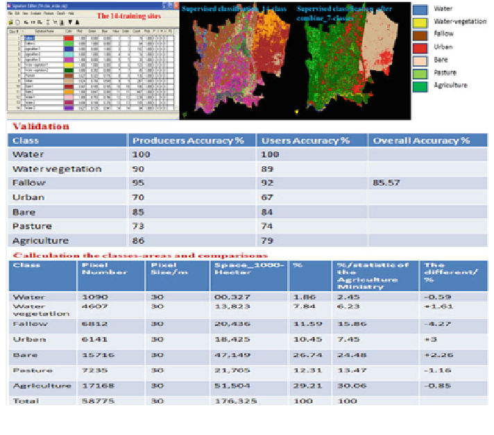
Fig. 5.17
The followed methodology for collecting the results during the ''office-work''
using the automated accuracy assessment based on trusted data (e.g., aerial pho-
tographs, GPS-measurements, etc.); and the second manually comparing the
resulted readings from remote sensing data with the state statistical records. One
cannot separate between these two stages, especially when the desired classifica-
tion result reaches a very detailed level of information about the LULC-features
(e.g., crops mapping). Thus, these stages have been linked and described in the
same place here.
5.5 The Possibility of Spectral Separation Between Crops/
Spectral Considerations
Satellite data was procured based on agricultural crop calendars and separability
(dependant on crop cover, density, leaf area, crops growth stage, etc.) of the main
crops cultivated in the region. By application of remote sensing data in agriculture,
the observing of spectral of the crops at one exact stage is more common than
those over the entire growing season. Thus, the spectral behavior of plants and the
effects of the background surface (soil or water) should be well understood.
Search WWH ::

Custom Search