Geology Reference
In-Depth Information
Given the latitudinal climatic gradients along
the length of the Andes, it is not surprising that
the amount of sediment delivered to the offshore
trench varies significantly along strike. In
general, where arid climates prevail, the trench
is sediment starved, whereas in regions with
more erosive climates, the trench may hold
sediment more than 2 km thick. Because
sediments contain abundant fluids and because
fluids cannot support shear stresses, interplate
stresses within subduction zones are proposed
to be low where sediment thicknesses are high,
and vice versa (Lamb and Davis, 2003; Melnick
and Echtler, 2006). In addition, thick blankets of
sediment may mantle irregular sea-floor topo-
graphy and, thereby, reduce the stresses that
the uneven topography would produce in the
absence of sediments (Fisher
et al
., 1998). Along
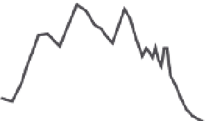
the length of the Andes, the maximum range
height and the depth of the sea floor in the off-
shore trench are correlated (Fig. 10.36A). In
general, trench depth is a function of the thick-
ness of sediment fill, such that a shallower
trench is associated with thicker fill.
If the lithosphere of the high Andes is weak,
as several tectonic characteristics suggest (Lamb
and Davis, 2003), then the potential energy dif-
ference between the range crest and the trench
(the buoyancy stress contrast) must be partially
supported by lateral push from the subducting
plate. Calculations of the shear stresses on the
plate interface that would be required to bal-
ance the buoyancy stress contrasts (Fig. 10.36B)
suggest that, where these rise above 35 MPa
and 100 MPa, respectively, the trench fill is thin
(<500 m) or absent. If this model is correct, then
the aridification of the western Andes has impor-
tant consequences for the growth of the range.
When such aridification occurred is poorly
documented, but it may be associated with the
mid-Miocene growth of the Antarctic ice sheets
and the strengthening of the cool Peru-Chile
Current along South America's western coast
(Lamb and Davis, 2003).
The role of sediment in the southern Andean
trench has also been invoked to explain a major
change from forearc extension and subsidence
to forearc uplift, inversion, and shortening
(Melnick and Echtler, 2006). Here, offshore of
Andean Topography, Stress, and Sediment Fill
no arc
& flat
slab
arc &
steep
slab
arc &
steep
slab
no arc
& flat
slab
8
6
Cordillera
Blanca
Bolivian
Altiplano
Chilean
Andes
4
2
0
m
Latitude (°S)
5
0
5
0
5
0
5
0
5
-2
Nazca
Ridge
-4
-6
-8
60
A
buoyancy stress
contrast
>100 MPa
50
shear stress
>35 MPa
40
shear
stress
<35
MPa
30
Trench
Fill (km)
n
o ill
20
10
B
0.5-2.5
20
0
5
10
15
25
30
35
40
45
Latitude (°S)
C
>>10 cm/yr
5-10 cm/yr
<5 cm/yr
Fig. 10.36
Andean topography, plate-interface
stresses, trench fill, and climate.
A. Maximum range height and sea-floor depth are well
correlated along the length of the Andes. B. Average
shear stress on the plate interface required to balance
the buoyancy stresses due to the contrast in potential
energy between the High Andes and the trench.
Calculated shear stresses >35 MPa and buoyancy stress
contrasts >100 MPa occur where trench fill is thin or
absent. The mean is corrected for the relative plate
convergence direction. C. Latitudinal zonations of
coastal rainfall. Low rainfall generally coincides with
thin trench fill. Modified after Lamb and Davis (2003).
the Patagonian Andes, extensive glaciation dur-
ing the past 5 Myr has dumped a large quantity
of sediment into the trench, where seismic data
reveal an increase in sediment thickness from
<1 km to >2 km since 5 Ma. Many of these water-
rich sediments have either been accreted to the