Geology Reference
In-Depth Information
then changes in provenance and fluvial charac-
ter, such as in paleodischarge calculations, can
also indicate past river capture events. In rapidly
eroding orogens (>1 km/Myr), the geomorphic
signal of river captures has a short residence
time. Within 100 kyr after a capture, many tens
of meters of bedrock will have been eroded,
most older river terraces will have been oblite-
rated, and channels will have adjusted to new
gradients and discharge. In more slowly eroding
orogens, histories of drainage evolution and
river capture can sometimes be reconstructed.
One of the more spectacular examples of
orogen-scale catchment expansion through
successive capture events has been proposed for
the Yangtze River in western China (Clark
et al
.,
2004). Today, the Yangtze is about 6300 km long,
its catchment encompasses nearly 2 × 10
6
km
2
,
and it spans from the Tibetan Plateau to the East
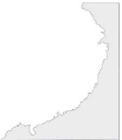
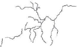
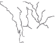
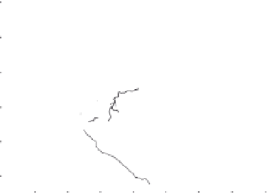
China Sea (Fig. 10.19). The river's map pattern
reveals many barbed junctions and a highly
convoluted river course. In a few sites, reversals
of drainage are inferred from upstream-sloping
river terraces. Five major capture events have
been proposed to have more than doubled the
Yangtze's catchment area (Clark
et al
., 2004).
The timing of these events is not well defined,
but they are inferred to have migrated from east
to west as each successive capture increased
the paleo-Yangtze's discharge and would be
expected to have driven a knickpoint up the
newly captured river, thereby promoting enhan-
ced headwater erosion and subsequent capture
events. Although the timing of capture events
remains elusive, future analyses of drill cores
from near the Yangtze's outlet in the East China
Sea and the Red River's outlet in the South China
Sea (Fig. 10.19) will likely reveal the chronology
and provenance data needed to test and calibrate
the overall river-capture model.
Whereas geomorphic evidence currently
provides the primary support for the Yangtze
River synthesis, offshore isotopic and seismic
data have been used to deduce other continen-
tal-scale river capture events. In the western
Himalaya, for example, the five major rivers of
the Punjab (which means the “country of five
rivers” in Sanskrit), which now flow southwest
into the Indus River, have been interpreted on
A
Middle
Yangtze
Lower
Yangtze
33°
27°
East
China
Sea
future
drainage
reversal
original
flow
direction
Pre-Capture
Catchments
250
km
21°
South China Sea
96°
102°
108°
114°
120°
B
Modern Yangtze
33°
1
Tibetan
Plateau
2
5
4
East
China
Sea
27°
3
Captures Creating
Modern Yangtze
drainage
reversal
capture
sequence
250
km
3
21°
South China Sea
96°
102°
108°
114°
120°
Fig. 10.19
Growth of the Yangtze catchment through
river capture.
A. Proposed pre-capture network geometry in which
rivers in the western half of the Yangtze's current
drainage flowed into the Red River. B. Sequence of
drainage reversals and captures that is proposed to
progress from east to west through time. Modified after
Clark
et al
. (2004).
the basis of Miocene paleocurrents to have
flowed southeast into the Ganges River (Burbank
et al
., 1996a). New evidence to support this
apparent switch in drainage from the east side
of the Indian subcontinent to the west side has
emerged from the sedimentary record in the
northern Arabian Sea near the mouth of the
Indus River. There, a major increase in sediment
discharge from the Indus after the Miocene, as
deduced from seismic data, is coeval with a
change in neodymium isotopes that reveals a
change in source areas (Clift and Blusztajn,
2005). These isotopes suggest an increase in
contributions from the Greater Himalaya (where
the headwaters of the Punjab rivers currently
reside) at the expense of contributions from the
Indus suture zone (which the Indus River seems
to have persistently drained during Neogene


