Geology Reference
In-Depth Information
can be relatively insensitive to reactivation of old
faults. Furthermore, if renewed faulting has been
insufficient to restore a linear range front, even a
presently active mountain front will appear
embayed on a topographic map.
If rates of tectonic activity decrease or stop,
then surface processes will dominate further
evolution of the landscape. Lateral planation
by transverse rivers will widen their valleys
within the mountains, and gradual back-
wearing will decrease their gradients. As valley
widening extends into the footwall uplift,
lateral and frontal slopes of triangular facets
will be further reduced, and the mountain front
will become increasingly embayed. Within the
depositional basin, decreasing subsidence will
decrease the space available for deposition,
leading to progradation of the transverse
fans, fanhead entrenchment, and basinward
displacement of axial rivers or lacustrine
depocenters (Fig. 10.4B).
In order to evaluate mountain-front sinuosity
along an extensive range front, criteria for sub-
dividing the range front into segments can serve
to limit the extent to which non-tectonic varia-
bility influences topographic measures of rela-
tive fault activity. Such criteria could include:
major changes in lithologic resistance, major
changes in the orientation of the range front or
steps in the bounding faults (Fig. 4.16), changes
in footwall lithology, cross-cutting river valleys
that are large in proportion to the range, and
significant changes in the geomorphic character
of the range (Wells
et al
., 1988).
Topographic cross-sections parallel to the
mountain front, but within the footwall block,
can be examined to determine the ratio of valley
width to the height,
R
, of the adjacent drainage
divides (Fig. 10.8) in order to evaluate the effect
of tectonism on valley geometries (Bull and
McFadden, 1977). Low width-to-height ratios
suggest prolonged incision and uplift, whereas
high ratios indicate that degradational pro-
cesses, such as valley widening and ridge-crest
lowering, have dominated the recent landscape.
Because it takes time for base-level effects to
propagate upstream into the footwall block,
measurements are usually made close to the
range front, e.g., 1 km up-valley. The width of
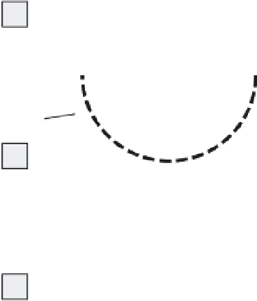
Cross-Valley Profiles as
Keys to Tectonic Activity
left
divide
height
valley-floor
width
right
divide
height
A
radius
=
height
semi-
circle
B
V ratios
0.38
1.0
0.71
C
Fig. 10.8
Measurements of valley shapes in footwall
blocks.
A. Valley-floor width-to-height ratio. B. Parameters for
calculating a “V ratio.” C. Examples of V ratios for
several valley shapes.
the valley floor,
w
vf
, is divided by the mean relief
represented by the height of the right and left
drainage divides,
e
ddr
and
e
ddl
, respectively, above
the valley bottom,
e
vb
:
w
R
=
vf
(10.2)
[(
e
−+ −
e
)
(
e
e
)]
1
2
ddr
vb
ddl
vb
Another way to evaluate the cross-valley
profiles is to determine the ratio of the area of
the actual valley cross-section (in other words,
that region that has been eroded away) to the
area of a semicircle with a radius equal to the
height of the adjacent drainage divide (Mayer,
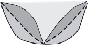
1986) (Fig. 10.8). Valley ratios (V ratios) near to
or greater than 1.0 signify U-shaped valleys
that are typically broad and shallow, whereas
valleys with V ratios less than 0.5 are usually
steeply incised (Fig. 10.8). Interpretation of
the valley-floor width-to-height ratios can be