Geology Reference
In-Depth Information
the vast majority of folds identified within the
entire geological record are essentially unknown.
By developing a chronology that spans 100 kyr,
these dates at Wheeler Ridge provide unique
insights on the mean rates of anticlinal growth
and facilitate development of more detailed and
reliable kinematic models of fold growth and
geomorphic dissection.
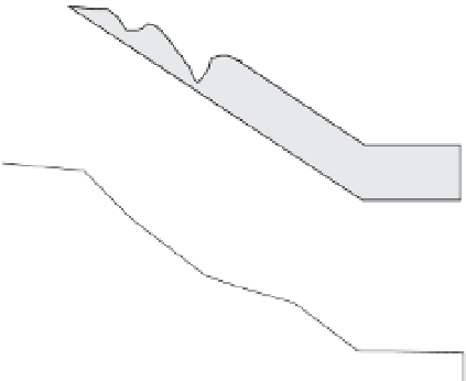
The drainage geometry and topography in the
vicinity of Wheeler Ridge reveal interactions
between fold growth and river responses (Figs
4.39 and 9.25). Whereas the floor of the wind gap
has been uplifted
∼
100 m above the expected
fluvial gradient across the current fold, the crest
of the fold lies 300 m above the floor of the
paleovalley. Hence, an antecedent river had
successfully incised across the fold during about
three-fourths of its vertical growth. An asymmetric
catchment funnels runoff from near the current
wind gap to the present water gap (Fig. 4.39).
This asymmetry suggests the direction of fold
propagation and river diversion. At the current
water gap, the fold is narrower than at the wind
gap and the upstream catchment is larger, such
that the discharge and potential stream power
(dependent on channel slope) would also be
greater. Given the approximately 200 m of relief
bounding the water gap (Figs 4.39 and 9.25), it,
too, has persisted for a considerable interval of
fold growth. Drainage on the fan to the east of the
fold swings around the fold nose and converges
toward the northwest, where finer-grained
sediment accumulates in a depositional “shadow
zone” in the lee of Wheeler Ridge (Fig. 4.39B).
In the context of the reconstructed history
of fold growth, the geomorphic responses to
folding and the modification of the fold by
surface processes can also be examined in more
detail than is commonly possible. The apparently
systematic eastward propagation of the Wheeler
Ridge anticline permits the ergodic hypothesis
to be applied. Visual inspection of Wheeler
Ridge (Fig. 4.39A) clearly shows significant
changes in the character of the land surface
along the length of the fold. Initially, as the nose
of the fold propagates eastward, a planar region
of the alluvial surface is uplifted and gently
folded. At this point, the geomorphic surface
should precisely mimic the structural geometry
wind
gap
Calibrated Fold
Propagation
water
gap
90-150 ka
30-60 ka
15-30 ka
400 m
7 ka
structural
uplift: ~4 mm/yr
lateral propagation
~2.25 cm/yr
sea
level
well control
~10°
plunge
of fold
Tulare Fm.
San Joaquin Fm
.
-400 m
0
1
2
kilometers
3
4
west
east
Fig. 9.25
Calibrated rates of fold propagation,
crestal uplift, and sediment aggradation for Wheeler
Ridge.
Schematic cross-section along the plunging axis of
Wheeler Ridge anticline, showing ages, relief, and
propagation rates based on well data. Note the
importance of surface ages for defining the rates of
uplift, propagation, and sedimentation. Modified after
Medwedeff (1992).
ages will constrain the initiation of fold growth
at those points. Based on soil stratigraphy and
both radiocarbon and uranium-series dates at
Wheeler Ridge (Fig. 9.25), the youngest uplifted
area at the emergent eastern end of the anticline
is dated at about 7 ka, whereas the alluvial
surfaces just east of the wind gap are estimated
to date from 90-150 ka (Keller
et al.
, 1998;
Medwedeff, 1992; Zepeda, 1993). When combined
with the structural and stratigraphic data, the
ages indicate that, during the past 100 kyr,
sediment accumulated in the adjacent basin at a
rate of about 2 mm/yr, and the crest of the fold
uplifted at a rate of about 4 mm/yr, while the
nose of the fold propagated eastward at a rate of
about 25 mm/yr.
If one were to assume that a significant
earthquake occurs on the underlying fault once
every 400 years, these rates imply that, with
each rupture, the fold crest would be uplifted
approximately 1-2 m, and the fault would extend
its eastern tip about 10 m. The rates of growth of