Geology Reference
In-Depth Information
that will permit a choice among the competing
alternatives.
Differential Erosion & Relief
weathering,
creep, wash,
landslides
hillslopes
Rates of erosion and denudation
river
hillslope
lowering
hillslope
lowering
Definitions
The changing vertical position of a point on the
land surface (Fig. 7.2) at any time is a function
(England and Molnar, 1990) of: (i) the rate at
which bedrock is being carried upward by
tectonic or isostatic processes (known as the
“bedrock uplift rate”); (ii) the rate at which mate-
rial in the subsurface is compacting; and (iii) the
rate of denudation or deposition at the surface:
river incision
A
hillslope lowering > river incision
surface uplift
=
bedrock uplift
+
deposition
hillslope
lowering
−
compaction
−
erosion
river incision
B
Bedrock uplift and deposition contribute to
raising the land surface, whereas erosion and
compaction serve to lower it. Because compac-
tion and deposition both occur primarily in
sedimentary basins near local base level, they
are generally ignored in this chapter in favor of
denudation and bedrock uplift, which are the
main determinants of topography in tectonically
active or mountainous landscapes.
Denudation
results from the removal of
material from a point or region on the Earth's
surface and can occur in response to two
very different processes.
Geomorphic erosion
(referred to subsequently simply as “erosion”)
results from mechanical and chemical weathering
of rock and removal of loosened or dissolved
material by geomorphic agents. Although
erosional removal of debris is often incremental,
processes like deep-seated, bedrock-involved
landsliding can be instantaneous and volumetri-
cally significant.
Tectonic denudation
typically
occurs through processes of extension and
normal faulting, and such denudation can result
in the rapid removal of large volumes of nearly
solid rock. A common reference frame for
calculating rates of denudation is the geometry
of the past land surface.
Surface uplift
or
surface
lowering
generally refer to changes in the eleva-
tion of a surface, whereas
bedrock uplift
refers
to changes in the vertical position of rocks with
alluviation, lowered slopes
hillslope lowering < river incision
hillslope
lowering
river
incision
C
incision, steepened slopes
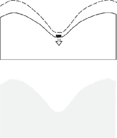
Fig. 7.1
Hillslope-river coupling.
River-incision rates define changes in base level for
adjacent hillslopes. Differences in the relative rate of
river incision versus hillslope lowering control changes
in topographic relief. A. In steady-state topography, rates
of river incision and of hillslope lowering are balanced.
B. If hillslope lowering exceeds river incision, valleys
tend to alluviate, and topographic relief decreases.
C. If river incision exceeds hillslope lowering, relief
increases and hillslopes steepen. If steepened slopes
drive faster hillslope erosion, the coupled system can
move toward a steady state.
ones? What drives changes in topographic
relief? This chapter does not answer these ques-
tions. Rather, it encompasses a rich variety of
approaches that help to define the key attributes