Geology Reference
In-Depth Information
tectonic signal will rise well above the geomorphic
noise and that the coral stratigraphy can yield
direct insights on seismic hazards.
0
T
March 2005
Uplift (cm)
100
75
25
150
100
50
125
Simeulue
Island
75
Far-field techniques
75
50
25
Coseismic
Uplift
0
Very-long-baseline interferometry (VLBI)
150
100
In order to define relative motion between
lithospheric plates, near-field measurement
techniques are both inadequate, inappropriate,
and time-consuming. To measure between plate
interiors that are assumed to be relatively
stable, a technique is required that permits
precise distances to be measured over distances
of hundreds to thousands of kilometers. VLBI
was developed in the late 1960s as a technique
to study compact extragalactic radio sources.
Since then, VLBI has evolved to become a
geophysical tool for study of real-time tectonics.
In the last three decades, the technology has
developed rapidly and is now in its third
generation. The discoveries using this new
technique have at times been surprising and
have helped change the way we think
about the integrity of the lithospheric plates. For
a summary of the development of VLBI
techniques and applications, see Ryan and Ma
(1998).
The VLBI system utilizes two or more widely
separated radio telescopes simultaneously
observing radiation from very distant (extra-
galactic) radio sources, typically quasars.
These sources are broadband in the sense that
they radiate in a wide range of frequencies.
Their extreme distance from Earth (billions of
light years) makes them very small, fixed
points in the sky, which therefore form good
reference points from which to measure
distances between sites on the Earth. The
complicated, random signal from the quasar
is recorded at very high rates and with very
accurate clocks at the two ends of each
baseline on the surface of the Earth.
The processing involves correlation of these
recordings in pairs, one pair for each baseline
in the network being observed. The signal
from one site is slowly shifted while the other
December 2004
A
T'
T'Coral survey site
Uplift
Proiles
T
T'
150
zone of
proposed
aseismic
slip
100
50
December 2004
March 2005
0
0
50
100
B
Distance along Simeulue profile (km)
3
2
1
0
-1
-2
-3
3
2
1
0
-1
-2
-3
2005 coseismic uplift
average
Holocene rate
Elastic Rebound
Holocene
uplift rate
0
20
40
60
80
C
Distance across Nias Island (km)
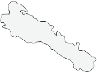
Fig. 5.14
Tectonic insights from coral-based geodesy.
A. Coseismic uplift patterns on Simeulue Island,
Sumatra, resulting from an
M
= 9.1 (December 2004)
earthquake and an
M
= 8.7 (March 2005) earthquake.
Note that peak deformation occurs at the opposite ends
of the island in each quake. B. Uplift profiles along the
length of the island (T-T
′
in A) show strong
displacement gradients and reveal a saddle of low
displacement, where aseismic slip on the megathrust is
postulated. C. On Nias Island (
∼
200 km southeast of
Simeulue), the pattern of coseismic uplift from the
March 2005 earthquake reveals no spatial correlation
with Holocene uplift rates. This decoupling between
coseismic and millennial deformation suggests that
almost all coseismic deformation represents elastic
rebound. Modified after Briggs
et al
. (2006, 2008).


